Willerwald geodata
Willerwald (Grand Est) is a populated place; located in France in Europe/Paris (GMT+2) time zone. With population of 1,262 people, there are 7220 cities with bigger population in this country. Compared to other cities in France, 80.3% of cities are located further ↓South; 95% of cities are located further ←West and 73.7% of cities have lower elevation than Willerwald. Note1
Administrative division(s):
- Level 1: Grand Est
- Level 2: Moselle
- Level 3: Arrondissement de Sarreguemines
- Level 4: Willerwald


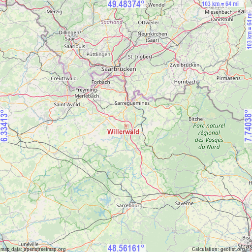
Willerwald GPS coordinates[2]
49° 1' 29.316" North, 7° 2' 14.136" East
| Map corner | latitude | longitude |
|---|---|---|
| Upper-left | 49.48374°, | 6.33413° |
| Center: | 49.02481°, | 7.03726° |
| Lower-right: | 48.56161°, | 7.74038° |
| Map W x H: | 102.5×102.5 km | = 63.7×63.7mi |
| max Lat: | 51.07786° ⇑19.7% North |
| Willerwald: | 49.02481° |
| min Lat: | ⇓80.3% South 41.3874° |
| min Long | Willerwald | max Long |
| -5.08615° | 7.03726° | 9.52242° |
| W 95%⇐ | ⇒5% E |
Elevation
Elevation of Willerwald is 240 m = 787 ft, and this is 46.3 m = 152 ft above average elevation for this country.
| Max E: |
2333 m = 7654 ft | 26.3% |
| Willerwald | 240 m 787 ft | |
| Avg. | 193.7 m = 635 ft | |
Min E: |
-1 m = -3 ft | 73.7% |
See also: France elevation on elevation.city.
Geographical zone
Willerwald is located in North temperate zone (between Tropic of Cancer and the Arctic Circle). Distance of this North polar circle is 1950.1 km =1211.7 mi to North.| Distance of | km | miles | from Willerwald |
|---|---|---|---|
| North Pole | 4556 | 2831 | to North |
| Arctic Circle | 1950.1 | 1211.7 | to North |
| Tropic Cancer | 2845.1 | 1767.9 | to South |
| Equator | 5451 | 3387.1 | to South |


Nearby cities:
15 places around Willerwald: (largest is in red/bold)
• Ernestviller
7.1 km =4.4 mi,  312°
312°
• Grundviller
5.2 km =3.2 mi,  294°
294°
• Hambach
3.9 km =2.4 mi,  357°
357°
• Herbitzheim
3.4 km =2.1 mi,  107°
107°
• Holving
5.4 km =3.4 mi,  254°
254°
• Keskastel
6 km =3.7 mi,  175°
175°
• Le Val-de-Guéblange
7.3 km =4.5 mi,  227°
227°
• Neufgrange
6.1 km =3.8 mi,  19°
19°
• Oermingen
7.2 km =4.5 mi, 112°
• Rémelfing
8.1 km =5 mi,  27°
27°
• Rémering-lès-Puttelange
7.4 km =4.6 mi,  280°
280°
• Sarralbe
3 km =1.9 mi,  189°
189°
• Siltzheim
5.9 km =3.7 mi,  43°
43°
• Wittring
8.3 km =5.2 mi,  67°
67°
• Woustviller
6.2 km =3.9 mi,  337°
337°
Sources, notices
• [Note1] Compared only with cities in France existing in our database
• [Src1] Map data: © OpenStreetMap contributors (CC-BY-SA)
• [Src2] Other city data from geonames.org with taken over terms of usage.
• [Src3] Geographical zone / Annual Mean Temperature by Robert A. Rohde @ Wikipedia
