Jouy-le-Châtel geodata
Jouy-le-Châtel (Île-de-France) is a populated place; located in France in Europe/Paris (GMT+2) time zone. With population of 1,525 people, there are 6104 cities with bigger population in this country. Compared to other cities in France, 72.4% of cities are located further ↓South; 59.7% of cities are located further ←West and 52% of cities have higher elevation than Jouy-le-Châtel. Note1
Administrative division(s):
- Level 1: Île-de-France
- Level 2: Seine-et-Marne
- Level 3: Arrondissement de Provins
- Level 4: Jouy-le-Châtel


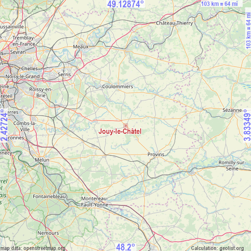
Jouy-le-Châtel GPS coordinates[2]
48° 39' 59.436" North, 3° 7' 49.296" East
| Map corner | latitude | longitude |
|---|---|---|
| Upper-left | 49.12874°, | 2.42724° |
| Center: | 48.66651°, | 3.13036° |
| Lower-right: | 48.2°, | 3.83349° |
| Map W x H: | 103.3×103.3 km | = 64.2×64.2mi |
| max Lat: | 51.07786° ⇑27.6% North |
| Jouy-le-Châtel: | 48.66651° |
| min Lat: | ⇓72.4% South 41.3874° |
| min Long | Jouy-le-Châtel | max Long |
| -5.08615° | 3.13036° | 9.52242° |
| W 59.7%⇐ | ⇒40.3% E |
Elevation
Elevation of Jouy-le-Châtel is 125 m = 410 ft, and this is 68.7 m = 225 ft below average elevation for this country.
| Max E: |
2333 m = 7654 ft | 52% |
| Avg. | 193.7 m = 635 ft | |
| Jouy-le-Châtel | 125 m = 410 ft | |
Min E: |
-1 m = -3 ft | 48% |
See also: France elevation on elevation.city.
Geographical zone
Jouy-le-Châtel is located in North temperate zone (between Tropic of Cancer and the Arctic Circle). Distance of this North polar circle is 1990 km =1236.5 mi to North.| Distance of | km | miles | from Jouy-le-Châtel |
|---|---|---|---|
| North Pole | 4595.9 | 2855.8 | to North |
| Arctic Circle | 1990 | 1236.5 | to North |
| Tropic Cancer | 2805.3 | 1743.1 | to South |
| Equator | 5411.2 | 3362.4 | to South |


Nearby cities:
15 places around Jouy-le-Châtel: (largest is in red/bold)
• Amillis
8.3 km =5.2 mi,  359°
359°
• Bannost-Villegagnon
4.7 km =2.9 mi,  73°
73°
• Beautheil
11.2 km =7 mi,  343°
343°
• Beton-Bazoches
9.2 km =5.7 mi, 65°
• Chenoise
7.5 km =4.7 mi,  140°
140°
• Chevru
9.2 km =5.7 mi,  31°
31°
• Choisy-en-Brie
12.1 km =7.5 mi, 31°
• Courpalay
12.6 km =7.8 mi,  261°
261°
• Gastins
9.1 km =5.7 mi,  242°
242°
• La Croix-en-Brie
9 km =5.6 mi,  206°
206°
• Pécy
3.7 km =2.3 mi,  250°
250°
• Saints
12.1 km =7.5 mi,  329°
329°
• Touquin
11.5 km =7.1 mi,  311°
311°
• Vaudoy-en-Brie
4.4 km =2.7 mi,  303°
303°
• Voinsles
9.6 km =6 mi,  286°
286°
Sources, notices
• [Note1] Compared only with cities in France existing in our database
• [Src1] Map data: © OpenStreetMap contributors (CC-BY-SA)
• [Src2] Other city data from geonames.org with taken over terms of usage.
• [Src3] Geographical zone / Annual Mean Temperature by Robert A. Rohde @ Wikipedia
