Jouarre geodata
Jouarre (Île-de-France) is a populated place; located in France in Europe/Paris (GMT+2) time zone. With population of 3,742 people, there are 2626 cities with bigger population in this country. Compared to other cities in France, 78.1% of cities are located further ↓South; 59.7% of cities are located further ←West and 53.1% of cities have lower elevation than Jouarre. Note1
Administrative division(s):
- Level 1: Île-de-France
- Level 2: Seine-et-Marne
- Level 3: Arrondissement de Meaux
- Level 4: Jouarre


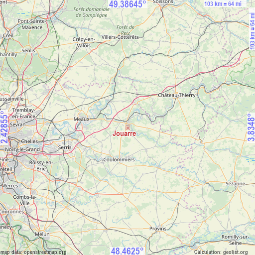
Jouarre GPS coordinates[2]
48° 55' 35.796" North, 3° 7' 54.048" East
| Map corner | latitude | longitude |
|---|---|---|
| Upper-left | 49.38645°, | 2.42855° |
| Center: | 48.92661°, | 3.13168° |
| Lower-right: | 48.4625°, | 3.8348° |
| Map W x H: | 102.7×102.7 km | = 63.8×63.8mi |
| max Lat: | 51.07786° ⇑21.9% North |
| Jouarre: | 48.92661° |
| min Lat: | ⇓78.1% South 41.3874° |
| min Long | Jouarre | max Long |
| -5.08615° | 3.13168° | 9.52242° |
| W 59.7%⇐ | ⇒40.3% E |
Elevation
Elevation of Jouarre is 143 m = 469 ft, and this is 50.7 m = 166 ft below average elevation for this country.
| Max E: |
2333 m = 7654 ft | 46.9% |
| Avg. | 193.7 m = 635 ft | |
| Jouarre | 143 m = 469 ft | |
Min E: |
-1 m = -3 ft | 53.1% |
See also: France elevation on elevation.city.
Geographical zone
Jouarre is located in North temperate zone (between Tropic of Cancer and the Arctic Circle). Distance of this North polar circle is 1961 km =1218.5 mi to North.| Distance of | km | miles | from Jouarre |
|---|---|---|---|
| North Pole | 4566.9 | 2837.7 | to North |
| Arctic Circle | 1961 | 1218.5 | to North |
| Tropic Cancer | 2834.2 | 1761.1 | to South |
| Equator | 5440.1 | 3380.3 | to South |


Nearby cities:
15 places around Jouarre: (largest is in red/bold)
• Chamigny
5.3 km =3.3 mi,  15°
15°
• Doue
7.1 km =4.4 mi,  161°
161°
• La Ferté-sous-Jouarre
2.8 km =1.7 mi,  353°
353°
• Luzancy
6.3 km =3.9 mi,  35°
35°
• Méry-sur-Marne
6.6 km =4.1 mi,  49°
49°
• Nanteuil-sur-Marne
8.6 km =5.3 mi, 48°
• Orly-sur-Morin
7.7 km =4.8 mi,  109°
109°
• Reuil-en-Brie
3.9 km =2.4 mi, 16°
• Saint-Cyr-sur-Morin
4.2 km =2.6 mi,  122°
122°
• Saint-Ouen-sur-Morin
5.8 km =3.6 mi, 118°
• Sainte-Aulde
8 km =5 mi, 21°
• Sammeron
4.2 km =2.6 mi,  302°
302°
• Saâcy-sur-Marne
7 km =4.3 mi,  55°
55°
• Signy-Signets
4.8 km =3 mi,  271°
271°
• Ussy-sur-Marne
5.4 km =3.4 mi,  307°
307°
Sources, notices
• [Note1] Compared only with cities in France existing in our database
• [Src1] Map data: © OpenStreetMap contributors (CC-BY-SA)
• [Src2] Other city data from geonames.org with taken over terms of usage.
• [Src3] Geographical zone / Annual Mean Temperature by Robert A. Rohde @ Wikipedia
