Doue geodata
Doue (Île-de-France) is a populated place; located in France in Europe/Paris (GMT+2) time zone. With population of 1,029 people, there are 8622 cities with bigger population in this country. Compared to other cities in France, 77% of cities are located further ↓South; 60.1% of cities are located further ←West and 53.3% of cities have lower elevation than Doue. Note1
Administrative division(s):
- Level 1: Île-de-France
- Level 2: Seine-et-Marne
- Level 3: Arrondissement de Provins
- Level 4: Doue


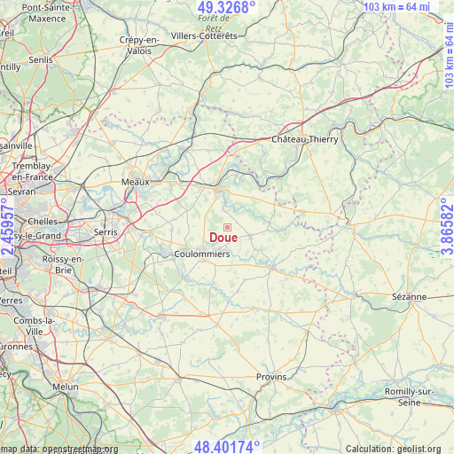
Doue GPS coordinates[2]
48° 51' 59.076" North, 3° 9' 45.684" East
| Map corner | latitude | longitude |
|---|---|---|
| Upper-left | 49.3268°, | 2.45957° |
| Center: | 48.86641°, | 3.16269° |
| Lower-right: | 48.40174°, | 3.86582° |
| Map W x H: | 102.9×102.9 km | = 63.9×63.9mi |
| max Lat: | 51.07786° ⇑23% North |
| Doue: | 48.86641° |
| min Lat: | ⇓77% South 41.3874° |
| min Long | Doue | max Long |
| -5.08615° | 3.16269° | 9.52242° |
| W 60.1%⇐ | ⇒39.9% E |
Elevation
Elevation of Doue is 144 m = 472 ft, and this is 49.7 m = 163 ft below average elevation for this country.
| Max E: |
2333 m = 7654 ft | 46.7% |
| Avg. | 193.7 m = 635 ft | |
| Doue | 144 m = 472 ft | |
Min E: |
-1 m = -3 ft | 53.3% |
See also: France elevation on elevation.city.
Geographical zone
Doue is located in North temperate zone (between Tropic of Cancer and the Arctic Circle). Distance of this North polar circle is 1967.7 km =1222.7 mi to North.| Distance of | km | miles | from Doue |
|---|---|---|---|
| North Pole | 4573.6 | 2841.9 | to North |
| Arctic Circle | 1967.7 | 1222.7 | to North |
| Tropic Cancer | 2827.5 | 1756.9 | to South |
| Equator | 5433.4 | 3376.2 | to South |


Nearby cities:
15 places around Doue: (largest is in red/bold)
• Boissy-le-Châtel
5.4 km =3.4 mi,  200°
200°
• Chailly-en-Brie
8.9 km =5.5 mi, 198°
• Chauffry
6.3 km =3.9 mi,  167°
167°
• Coulommiers
8.1 km =5 mi,  224°
224°
• Jouarre
7.1 km =4.4 mi,  341°
341°
• La Ferté-sous-Jouarre
9.8 km =6.1 mi, 344°
• Orly-sur-Morin
6.5 km =4 mi,  50°
50°
• Rebais
5.5 km =3.4 mi,  112°
112°
• Sablonnières
9.9 km =6.2 mi,  83°
83°
• Saint-Cyr-sur-Morin
4.7 km =2.9 mi,  15°
15°
• Saint-Denis-lès-Rebais
4.9 km =3 mi,  134°
134°
• Saint-Ouen-sur-Morin
4.9 km =3 mi,  35°
35°
• Saint-Rémy-la-Vanne
9.8 km =6.1 mi,  148°
148°
• Saint-Siméon
8.1 km =5 mi,  158°
158°
• Signy-Signets
9.8 km =6.1 mi,  314°
314°
Sources, notices
• [Note1] Compared only with cities in France existing in our database
• [Src1] Map data: © OpenStreetMap contributors (CC-BY-SA)
• [Src2] Other city data from geonames.org with taken over terms of usage.
• [Src3] Geographical zone / Annual Mean Temperature by Robert A. Rohde @ Wikipedia
