Jayat geodata
Jayat (Auvergne-Rhône-Alpes) is a populated place; located in France in Europe/Paris (GMT+2) time zone. With population of 839 people, there are 10196 cities with bigger population in this country. Compared to other cities in France, 61.5% of cities are located further ↑North; 78.9% of cities are located further ←West and 68.1% of cities have lower elevation than Jayat. Note1
Administrative division(s):
- Level 1: Auvergne-Rhône-Alpes
- Level 2: Département de l'Ain
- Level 3: Arrondissement de Bourg-en-Bresse
- Level 4: Jayat


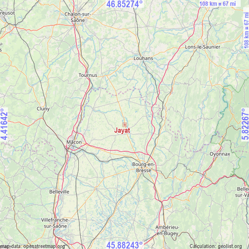
Jayat GPS coordinates[2]
46° 22' 11.064" North, 5° 7' 10.38" East
| Map corner | latitude | longitude |
|---|---|---|
| Upper-left | 46.85274°, | 4.41642° |
| Center: | 46.36974°, | 5.11955° |
| Lower-right: | 45.88243°, | 5.82267° |
| Map W x H: | 107.9×107.9 km | = 67×67mi |
| max Lat: | 51.07786° ⇑61.5% North |
| Jayat: | 46.36974° |
| min Lat: | ⇓38.5% South 41.3874° |
| min Long | Jayat | max Long |
| -5.08615° | 5.11955° | 9.52242° |
| W 78.9%⇐ | ⇒21.1% E |
Elevation
Elevation of Jayat is 210 m = 689 ft, and this is 16.3 m = 53 ft above average elevation for this country.
| Max E: |
2333 m = 7654 ft | 31.9% |
| Jayat | 210 m 689 ft | |
| Avg. | 193.7 m = 635 ft | |
Min E: |
-1 m = -3 ft | 68.1% |
See also: France elevation on elevation.city.
Geographical zone
Jayat is located in North temperate zone (between Tropic of Cancer and the Arctic Circle). Distance of this North polar circle is 2245.3 km =1395.2 mi to North.| Distance of | km | miles | from Jayat |
|---|---|---|---|
| North Pole | 4851.2 | 3014.4 | to North |
| Arctic Circle | 2245.3 | 1395.2 | to North |
| Tropic Cancer | 2549.9 | 1584.4 | to South |
| Equator | 5155.8 | 3203.7 | to South |


Nearby cities:
15 places around Jayat: (largest is in red/bold)
• Attignat
9.9 km =6.2 mi,  160°
160°
• Cras-sur-Reyssouze
8 km =5 mi,  149°
149°
• Curtafond
11 km =6.8 mi,  192°
192°
• Foissiat
4.3 km =2.7 mi,  87°
87°
• Lescheroux
4.4 km =2.7 mi,  25°
25°
• Malafretaz
5.5 km =3.4 mi, 161°
• Marboz
11 km =6.8 mi,  105°
105°
• Marsonnas
4.9 km =3 mi,  229°
229°
• Montrevel-en-Bresse
3.8 km =2.4 mi,  176°
176°
• Saint-Jean-sur-Reyssouze
5.3 km =3.3 mi,  303°
303°
• Saint-Julien-sur-Reyssouze
3.8 km =2.4 mi,  347°
347°
• Saint-Martin-le-Châtel
10.1 km =6.3 mi, 181°
• Saint-Nizier-le-Bouchoux
10.4 km =6.5 mi,  13°
13°
• Saint-Trivier-de-Courtes
10.5 km =6.5 mi,  342°
342°
• Étrez
6.5 km =4 mi,  127°
127°
Sources, notices
• [Note1] Compared only with cities in France existing in our database
• [Src1] Map data: © OpenStreetMap contributors (CC-BY-SA)
• [Src2] Other city data from geonames.org with taken over terms of usage.
• [Src3] Geographical zone / Annual Mean Temperature by Robert A. Rohde @ Wikipedia
