Saint-Jean-sur-Reyssouze geodata
Saint-Jean-sur-Reyssouze (Auvergne-Rhône-Alpes) is a populated place; located in France in Europe/Paris (GMT+2) time zone. With population of 631 people, there are 12802 cities with bigger population in this country. Compared to other cities in France, 61.1% of cities are located further ↑North; 78.3% of cities are located further ←West and 64.4% of cities have lower elevation than Saint-Jean-sur-Reyssouze. Note1
Administrative division(s):
- Level 1: Auvergne-Rhône-Alpes
- Level 2: Département de l'Ain
- Level 3: Arrondissement de Bourg-en-Bresse
- Level 4: Saint-Jean-sur-Reyssouze
Current local time in Saint-Jean-sur-Reyssouze:
04:15 PM, SaturdayDifference from your time zone: hours


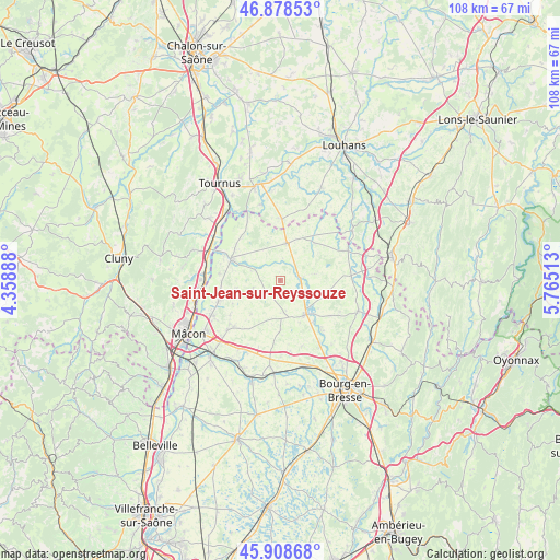
Saint-Jean-sur-Reyssouze GPS coordinates[2]
46° 23' 44.736" North, 5° 3' 43.236" East
| Map corner | latitude | longitude |
|---|---|---|
| Upper-left | 46.87853°, | 4.35888° |
| Center: | 46.39576°, | 5.06201° |
| Lower-right: | 45.90868°, | 5.76513° |
| Map W x H: | 107.8×107.8 km | = 67×67mi |
| max Lat: | 51.07786° ⇑61.1% North |
| Saint-Jean-sur-Reyssouze: | 46.39576° |
| min Lat: | ⇓38.9% South 41.3874° |
| min Long | Saint-Jean-sur- | max Long |
| -5.08615° | 5.06201° | 9.52242° |
| W 78.3%⇐ | ⇒21.7% E |
Elevation
Elevation of Saint-Jean-sur-Reyssouze is 191 m = 627 ft, and this is 2.7 m = 9 ft below average elevation for this country.
| Max E: |
2333 m = 7654 ft | 35.6% |
| Avg. | 193.7 m = 635 ft | |
| Saint-Jean-sur-Reyssouze | 191 m = 627 ft | |
Min E: |
-1 m = -3 ft | 64.4% |
See also: France elevation on elevation.city.
Geographical zone
Saint-Jean-sur-Reyssouze is located in North temperate zone (between Tropic of Cancer and the Arctic Circle). Distance of this North polar circle is 2242.4 km =1393.4 mi to North.| Distance of | km | miles | from Saint-Jean-sur-Reyssouze |
|---|---|---|---|
| North Pole | 4848.3 | 3012.6 | to North |
| Arctic Circle | 2242.4 | 1393.4 | to North |
| Tropic Cancer | 2552.8 | 1586.2 | to South |
| Equator | 5158.7 | 3205.5 | to South |


Nearby cities:
15 places around Saint-Jean-sur-Reyssouze: (largest is in red/bold)
• Chavannes-sur-Reyssouze
6.4 km =4 mi,  308°
308°
• Chevroux
8.5 km =5.3 mi,  260°
260°
• Foissiat
9.1 km =5.7 mi,  107°
107°
• Gorrevod
9.3 km =5.8 mi,  286°
286°
• Jayat
5.3 km =3.3 mi,  123°
123°
• Lescheroux
6.4 km =4 mi,  80°
80°
• Malafretaz
10.2 km =6.3 mi,  142°
142°
• Marsonnas
6.1 km =3.8 mi,  173°
173°
• Montrevel-en-Bresse
8.2 km =5.1 mi,  145°
145°
• Ozan
11.3 km =7 mi,  267°
267°
• Pont-de-Vaux
9.9 km =6.2 mi, 294°
• Saint-Bénigne
8.4 km =5.2 mi,  304°
304°
• Saint-Julien-sur-Reyssouze
3.7 km =2.3 mi, 77°
• Saint-Nizier-le-Bouchoux
9.9 km =6.2 mi,  43°
43°
• Saint-Trivier-de-Courtes
7.2 km =4.5 mi,  9°
9°
Sources, notices
• [Note1] Compared only with cities in France existing in our database
• [Src1] Map data: © OpenStreetMap contributors (CC-BY-SA)
• [Src2] Other city data from geonames.org with taken over terms of usage.
• [Src3] Geographical zone / Annual Mean Temperature by Robert A. Rohde @ Wikipedia
