Izel-lès-Hameau geodata
Izel-lès-Hameau (Hauts-de-France) is a populated place; located in France in Europe/Paris (GMT+2) time zone. With population of 682 people, there are 12047 cities with bigger population in this country. Compared to other cities in France, 95.7% of cities are located further ↓South; 51.1% of cities are located further ←West and 53.3% of cities have higher elevation than Izel-lès-Hameau. Note1
Administrative division(s):
- Level 1: Hauts-de-France
- Level 2: Pas-de-Calais
- Level 3: Arras
- Level 4: Izel-lès-Hameau


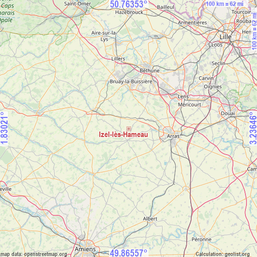
Izel-lès-Hameau GPS coordinates[2]
50° 19' 0.012" North, 2° 31' 59.988" East
| Map corner | latitude | longitude |
|---|---|---|
| Upper-left | 50.76353°, | 1.83021° |
| Center: | 50.31667°, | 2.53333° |
| Lower-right: | 49.86557°, | 3.23646° |
| Map W x H: | 99.8×99.8 km | = 62×62mi |
| max Lat: | 51.07786° ⇑4.3% North |
| Izel-lès-Hameau: | 50.31667° |
| min Lat: | ⇓95.7% South 41.3874° |
| min Long | Izel-lès-Hamea | max Long |
| -5.08615° | 2.53333° | 9.52242° |
| W 51.1%⇐ | ⇒48.9% E |
Elevation
Elevation of Izel-lès-Hameau is 121 m = 397 ft, and this is 72.7 m = 239 ft below average elevation for this country.
| Max E: |
2333 m = 7654 ft | 53.3% |
| Avg. | 193.7 m = 635 ft | |
| Izel-lès-Hameau | 121 m = 397 ft | |
Min E: |
-1 m = -3 ft | 46.7% |
See also: France elevation on elevation.city.
Geographical zone
Izel-lès-Hameau is located in North temperate zone (between Tropic of Cancer and the Arctic Circle). Distance of this North polar circle is 1806.5 km =1122.5 mi to North.| Distance of | km | miles | from Izel-lès-Hameau |
|---|---|---|---|
| North Pole | 4412.4 | 2741.7 | to North |
| Arctic Circle | 1806.5 | 1122.5 | to North |
| Tropic Cancer | 2988.8 | 1857.2 | to South |
| Equator | 5594.7 | 3476.4 | to South |


Nearby cities:
15 places around Izel-lès-Hameau: (largest is in red/bold)
• Acq
9.4 km =5.8 mi,  68°
68°
• Agnez-lès-Duisans
8.9 km =5.5 mi,  96°
96°
• Aubigny-en-Artois
5.1 km =3.2 mi,  43°
43°
• Avesnes-le-Comte
4.3 km =2.7 mi,  183°
183°
• Duisans
10.9 km =6.8 mi, 96°
• Fresnicourt-le-Dolmen
12.3 km =7.6 mi,  22°
22°
• Habarcq
5.6 km =3.5 mi, 103°
• Magnicourt-en-Comte
9.6 km =6 mi,  345°
345°
• Marœuil
12.2 km =7.6 mi,  85°
85°
• Mont-Saint-Éloi
11.9 km =7.4 mi, 71°
• Roëllecourt
11.9 km =7.4 mi,  298°
298°
• Savy-Berlette
4.6 km =2.9 mi,  29°
29°
• Simencourt
10.1 km =6.3 mi,  130°
130°
• Tincques
5.5 km =3.4 mi,  328°
328°
• Wanquetin
7.3 km =4.5 mi, 128°
Sources, notices
• [Note1] Compared only with cities in France existing in our database
• [Src1] Map data: © OpenStreetMap contributors (CC-BY-SA)
• [Src2] Other city data from geonames.org with taken over terms of usage.
• [Src3] Geographical zone / Annual Mean Temperature by Robert A. Rohde @ Wikipedia
