Mont-Saint-Éloi geodata
Mont-Saint-Éloi (Hauts-de-France) is a populated place; located in France in Europe/Paris (GMT+2) time zone. With population of 1,035 people, there are 8575 cities with bigger population in this country. Compared to other cities in France, 96% of cities are located further ↓South; 53.3% of cities are located further ←West and 50.1% of cities have lower elevation than Mont-Saint-Éloi. Note1
Administrative division(s):
- Level 1: Hauts-de-France
- Level 2: Pas-de-Calais
- Level 3: Arras
- Level 4: Mont-Saint-Éloi


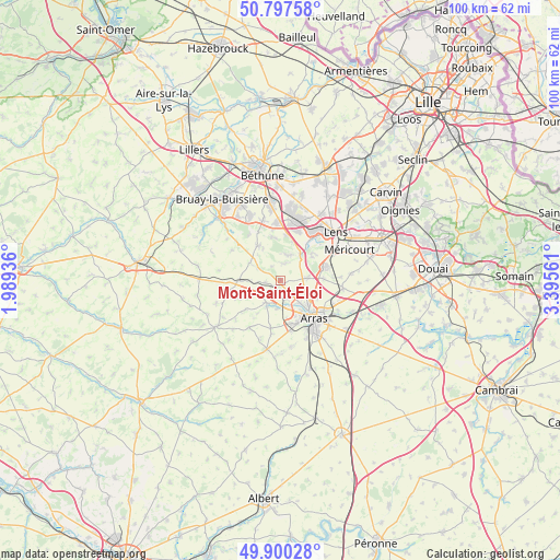
Mont-Saint-Éloi GPS coordinates[2]
50° 21' 3.78" North, 2° 41' 32.964" East
| Map corner | latitude | longitude |
|---|---|---|
| Upper-left | 50.79758°, | 1.98936° |
| Center: | 50.35105°, | 2.69249° |
| Lower-right: | 49.90028°, | 3.39561° |
| Map W x H: | 99.8×99.8 km | = 62×62mi |
| max Lat: | 51.07786° ⇑4% North |
| Mont-Saint-Éloi: | 50.35105° |
| min Lat: | ⇓96% South 41.3874° |
| min Long | Mont-Saint-Élo | max Long |
| -5.08615° | 2.69249° | 9.52242° |
| W 53.3%⇐ | ⇒46.7% E |
Elevation
Elevation of Mont-Saint-Éloi is 132 m = 433 ft, and this is 61.7 m = 202 ft below average elevation for this country.
| Max E: |
2333 m = 7654 ft | 49.9% |
| Avg. | 193.7 m = 635 ft | |
| Mont-Saint-Éloi | 132 m = 433 ft | |
Min E: |
-1 m = -3 ft | 50.1% |
See also: France elevation on elevation.city.
Geographical zone
Mont-Saint-Éloi is located in North temperate zone (between Tropic of Cancer and the Arctic Circle). Distance of this North polar circle is 1802.7 km =1120.1 mi to North.| Distance of | km | miles | from Mont-Saint-Éloi |
|---|---|---|---|
| North Pole | 4408.5 | 2739.3 | to North |
| Arctic Circle | 1802.7 | 1120.1 | to North |
| Tropic Cancer | 2992.6 | 1859.5 | to South |
| Equator | 5598.5 | 3478.7 | to South |


Nearby cities:
15 places around Mont-Saint-Éloi: (largest is in red/bold)
• Ablain-Saint-Nazaire
4.8 km =3 mi,  13°
13°
• Acq
2.5 km =1.6 mi,  260°
260°
• Agnez-lès-Duisans
5.4 km =3.4 mi,  207°
207°
• Angres
7.8 km =4.8 mi,  38°
38°
• Anzin-Saint-Aubin
5.7 km =3.5 mi,  137°
137°
• Aubigny-en-Artois
7.7 km =4.8 mi,  269°
269°
• Carency
3.2 km =2 mi,  15°
15°
• Duisans
5 km =3.1 mi,  184°
184°
• Givenchy-en-Gohelle
7.2 km =4.5 mi,  52°
52°
• Marœuil
3 km =1.9 mi,  162°
162°
• Neuville-Saint-Vaast
5 km =3.1 mi,  81°
81°
• Roclincourt
7.2 km =4.5 mi,  112°
112°
• Sainte-Catherine
7 km =4.3 mi,  133°
133°
• Souchez
5.7 km =3.5 mi, 35°
• Thélus
7.7 km =4.8 mi,  87°
87°
Sources, notices
• [Note1] Compared only with cities in France existing in our database
• [Src1] Map data: © OpenStreetMap contributors (CC-BY-SA)
• [Src2] Other city data from geonames.org with taken over terms of usage.
• [Src3] Geographical zone / Annual Mean Temperature by Robert A. Rohde @ Wikipedia
