Avesnes-le-Comte geodata
Avesnes-le-Comte (Hauts-de-France) is a populated place; located in France in Europe/Paris (GMT+2) time zone. With population of 2,039 people, there are 4709 cities with bigger population in this country. Compared to other cities in France, 95.3% of cities are located further ↓South; 51% of cities are located further ←West and 51.1% of cities have lower elevation than Avesnes-le-Comte. Note1
Administrative division(s):
- Level 1: Hauts-de-France
- Level 2: Pas-de-Calais
- Level 3: Arras
- Level 4: Avesnes-le-Comte


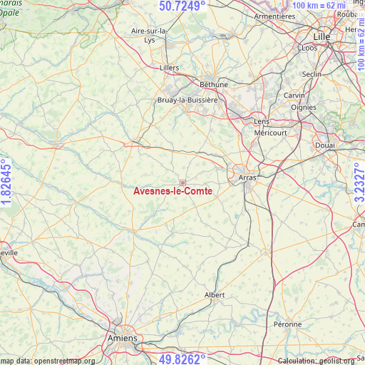
Avesnes-le-Comte GPS coordinates[2]
50° 16' 39.612" North, 2° 31' 46.452" East
| Map corner | latitude | longitude |
|---|---|---|
| Upper-left | 50.7249°, | 1.82645° |
| Center: | 50.27767°, | 2.52957° |
| Lower-right: | 49.8262°, | 3.2327° |
| Map W x H: | 99.9×99.9 km | = 62.1×62.1mi |
| max Lat: | 51.07786° ⇑4.7% North |
| Avesnes-le-Comte: | 50.27767° |
| min Lat: | ⇓95.3% South 41.3874° |
| min Long | Avesnes-le-Comt | max Long |
| -5.08615° | 2.52957° | 9.52242° |
| W 51%⇐ | ⇒49% E |
Elevation
Elevation of Avesnes-le-Comte is 136 m = 446 ft, and this is 57.7 m = 189 ft below average elevation for this country.
| Max E: |
2333 m = 7654 ft | 48.9% |
| Avg. | 193.7 m = 635 ft | |
| Avesnes-le-Comte | 136 m = 446 ft | |
Min E: |
-1 m = -3 ft | 51.1% |
See also: France elevation on elevation.city.
Geographical zone
Avesnes-le-Comte is located in North temperate zone (between Tropic of Cancer and the Arctic Circle). Distance of this North polar circle is 1810.8 km =1125.2 mi to North.| Distance of | km | miles | from Avesnes-le-Comte |
|---|---|---|---|
| North Pole | 4416.7 | 2744.4 | to North |
| Arctic Circle | 1810.8 | 1125.2 | to North |
| Tropic Cancer | 2984.4 | 1854.4 | to South |
| Equator | 5590.4 | 3473.7 | to South |


Nearby cities:
15 places around Avesnes-le-Comte: (largest is in red/bold)
• Acq
11.9 km =7.4 mi,  49°
49°
• Agnez-lès-Duisans
9.7 km =6 mi,  69°
69°
• Aubigny-en-Artois
8.9 km =5.5 mi,  25°
25°
• Beaumetz-lès-Loges
10.1 km =6.3 mi,  115°
115°
• Duisans
11.6 km =7.2 mi, 74°
• Habarcq
6.5 km =4 mi,  61°
61°
• Izel-lès-Hameau
4.3 km =2.7 mi,  3°
3°
• Lucheux
12.2 km =7.6 mi,  222°
222°
• Marœuil
13.5 km =8.4 mi, 67°
• Mondicourt
12.7 km =7.9 mi,  202°
202°
• Rivière
12.6 km =7.8 mi,  113°
113°
• Savy-Berlette
8.7 km =5.4 mi,  16°
16°
• Simencourt
8.3 km =5.2 mi, 105°
• Tincques
9.4 km =5.8 mi,  344°
344°
• Wanquetin
6 km =3.7 mi,  92°
92°
Sources, notices
• [Note1] Compared only with cities in France existing in our database
• [Src1] Map data: © OpenStreetMap contributors (CC-BY-SA)
• [Src2] Other city data from geonames.org with taken over terms of usage.
• [Src3] Geographical zone / Annual Mean Temperature by Robert A. Rohde @ Wikipedia
