Hautot-Saint-Sulpice geodata
Hautot-Saint-Sulpice (Normandy) is a populated place; located in France in Europe/Paris (GMT+2) time zone. With population of 575 people, there are 13746 cities with bigger population in this country. Compared to other cities in France, 91.4% of cities are located further ↓South; 71.1% of cities are located further →East and 51.4% of cities have lower elevation than Hautot-Saint-Sulpice. Note1
Administrative division(s):
- Level 1: Normandy
- Level 2: Seine-Maritime
- Level 3: Arrondissement de Rouen
- Level 4: Hautot-Saint-Sulpice


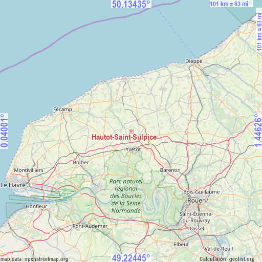
Hautot-Saint-Sulpice GPS coordinates[2]
49° 40' 53.508" North, 0° 44' 35.268" East
| Map corner | latitude | longitude |
|---|---|---|
| Upper-left | 50.13435°, | 0.04001° |
| Center: | 49.68153°, | 0.74313° |
| Lower-right: | 49.22445°, | 1.44626° |
| Map W x H: | 101.2×101.2 km | = 62.9×62.9mi |
| max Lat: | 51.07786° ⇑8.6% North |
| Hautot-Saint-Sulpice: | 49.68153° |
| min Lat: | ⇓91.4% South 41.3874° |
| min Long | Hautot-Saint-Su | max Long |
| -5.08615° | 0.74313° | 9.52242° |
| W 28.9%⇐ | ⇒71.1% E |
Elevation
Elevation of Hautot-Saint-Sulpice is 137 m = 449 ft, and this is 56.7 m = 186 ft below average elevation for this country.
| Max E: |
2333 m = 7654 ft | 48.6% |
| Avg. | 193.7 m = 635 ft | |
| Hautot-Saint-Sulpice | 137 m = 449 ft | |
Min E: |
-1 m = -3 ft | 51.4% |
See also: France elevation on elevation.city.
Geographical zone
Hautot-Saint-Sulpice is located in North temperate zone (between Tropic of Cancer and the Arctic Circle). Distance of this North polar circle is 1877.1 km =1166.4 mi to North.| Distance of | km | miles | from Hautot-Saint-Sulpice |
|---|---|---|---|
| North Pole | 4483 | 2785.6 | to North |
| Arctic Circle | 1877.1 | 1166.4 | to North |
| Tropic Cancer | 2918.1 | 1813.2 | to South |
| Equator | 5524.1 | 3432.5 | to South |


Nearby cities:
15 places around Hautot-Saint-Sulpice: (largest is in red/bold)
• Autretot
3.5 km =2.2 mi,  194°
194°
• Auzebosc
9.6 km =6 mi, 186°
• Bosville
9.1 km =5.7 mi,  334°
334°
• Criquetot-sur-Ouville
7.8 km =4.8 mi,  96°
96°
• Doudeville
5.5 km =3.4 mi,  33°
33°
• Grainville-la-Teinturière
10.4 km =6.5 mi,  314°
314°
• Héricourt-en-Caux
3.7 km =2.3 mi,  294°
294°
• Motteville
9.4 km =5.8 mi,  123°
123°
• Saint-Clair-sur-les-Monts
8.9 km =5.5 mi,  158°
158°
• Sainte-Marie-des-Champs
7.2 km =4.5 mi, 158°
• Valliquerville
8.5 km =5.3 mi,  208°
208°
• Veauville-lès-Baons
3.9 km =2.4 mi,  154°
154°
• Yvecrique
4.9 km =3 mi,  79°
79°
• Yvetot
7.2 km =4.5 mi,  171°
171°
• Écalles-Alix
9.2 km =5.7 mi,  141°
141°
Sources, notices
• [Note1] Compared only with cities in France existing in our database
• [Src1] Map data: © OpenStreetMap contributors (CC-BY-SA)
• [Src2] Other city data from geonames.org with taken over terms of usage.
• [Src3] Geographical zone / Annual Mean Temperature by Robert A. Rohde @ Wikipedia
