Hargarten-aux-Mines geodata
Hargarten-aux-Mines (Grand Est) is a populated place; located in France in Europe/Paris (GMT+2) time zone. With population of 1,168 people, there are 7719 cities with bigger population in this country. Compared to other cities in France, 84.7% of cities are located further ↓South; 92.4% of cities are located further ←West and 70.6% of cities have lower elevation than Hargarten-aux-Mines. Note1
Administrative division(s):
- Level 1: Grand Est
- Level 2: Moselle
- Level 3: Arrondissement de Forbach-Boulay-Moselle
- Level 4: Hargarten-aux-Mines


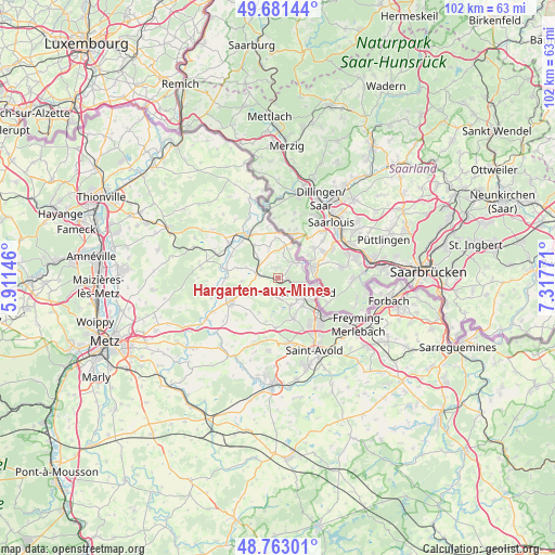
Hargarten-aux-Mines GPS coordinates[2]
49° 13' 27.696" North, 6° 36' 52.524" East
| Map corner | latitude | longitude |
|---|---|---|
| Upper-left | 49.68144°, | 5.91146° |
| Center: | 49.22436°, | 6.61459° |
| Lower-right: | 48.76301°, | 7.31771° |
| Map W x H: | 102.1×102.1 km | = 63.4×63.4mi |
| max Lat: | 51.07786° ⇑15.3% North |
| Hargarten-aux-Mines: | 49.22436° |
| min Lat: | ⇓84.7% South 41.3874° |
| min Long | Hargarten-aux-M | max Long |
| -5.08615° | 6.61459° | 9.52242° |
| W 92.4%⇐ | ⇒7.6% E |
Elevation
Elevation of Hargarten-aux-Mines is 222 m = 728 ft, and this is 28.3 m = 93 ft above average elevation for this country.
| Max E: |
2333 m = 7654 ft | 29.4% |
| Hargarten-aux-Mines | 222 m 728 ft | |
| Avg. | 193.7 m = 635 ft | |
Min E: |
-1 m = -3 ft | 70.6% |
See also: France elevation on elevation.city.
Geographical zone
Hargarten-aux-Mines is located in North temperate zone (between Tropic of Cancer and the Arctic Circle). Distance of this North polar circle is 1927.9 km =1197.9 mi to North.| Distance of | km | miles | from Hargarten-aux-Mines |
|---|---|---|---|
| North Pole | 4533.8 | 2817.2 | to North |
| Arctic Circle | 1927.9 | 1197.9 | to North |
| Tropic Cancer | 2867.3 | 1781.7 | to South |
| Equator | 5473.2 | 3400.9 | to South |


Nearby cities:
15 places around Hargarten-aux-Mines: (largest is in red/bold)
• Boucheporn
9.3 km =5.8 mi,  182°
182°
• Boulay-Moselle
9.5 km =5.9 mi,  241°
241°
• Bouzonville
9.5 km =5.9 mi,  322°
322°
• Coume
4.2 km =2.6 mi,  226°
226°
• Creutzwald
6.3 km =3.9 mi,  109°
109°
• Dalem
1.8 km =1.1 mi,  353°
353°
• Diesen
6.9 km =4.3 mi,  138°
138°
• Falck
1.4 km =0.9 mi,  78°
78°
• Guerting
4.1 km =2.5 mi,  171°
171°
• Ham-sous-Varsberg
5.5 km =3.4 mi,  154°
154°
• Merten
4.6 km =2.9 mi,  52°
52°
• Porcelette
8.1 km =5 mi,  158°
158°
• Téterchen
3.9 km =2.4 mi,  280°
280°
• Varsberg
5.8 km =3.6 mi, 169°
• Vaudreching
9.3 km =5.8 mi, 315°
Sources, notices
• [Note1] Compared only with cities in France existing in our database
• [Src1] Map data: © OpenStreetMap contributors (CC-BY-SA)
• [Src2] Other city data from geonames.org with taken over terms of usage.
• [Src3] Geographical zone / Annual Mean Temperature by Robert A. Rohde @ Wikipedia
