Grande-Synthe geodata
Grande-Synthe (Hauts-de-France) is a populated place; located in France in Europe/Paris (GMT+2) time zone. With population of 23,213 people, there are 383 cities with bigger population in this country. Compared to other cities in France, 99.9% of cities are located further ↓South; 52.8% of cities are located further →East and 99.9% of cities have higher elevation than Grande-Synthe. Note1
Administrative division(s):
- Level 1: Hauts-de-France
- Level 2: Nord
- Level 3: Arrondissement de Dunkerque
- Level 4: Grande-Synthe


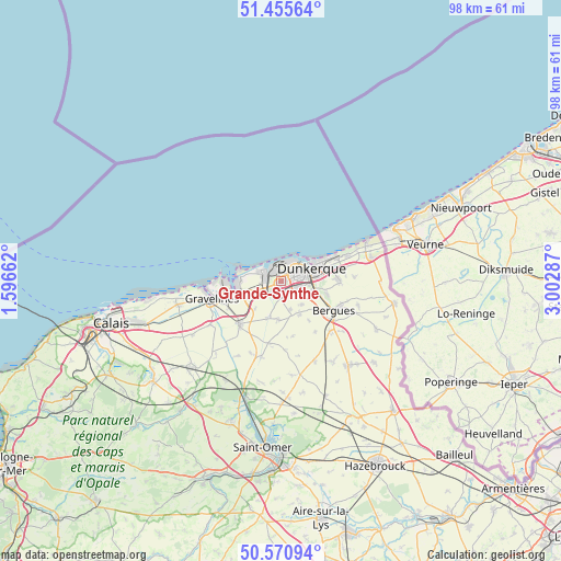
Grande-Synthe GPS coordinates[2]
51° 0' 55.44" North, 2° 17' 59.1" East
| Map corner | latitude | longitude |
|---|---|---|
| Upper-left | 51.45564°, | 1.59662° |
| Center: | 51.0154°, | 2.29975° |
| Lower-right: | 50.57094°, | 3.00287° |
| Map W x H: | 98.4×98.4 km | = 61.1×61.1mi |
| max Lat: | 51.07786° ⇑0.1% North |
| Grande-Synthe: | 51.0154° |
| min Lat: | ⇓99.9% South 41.3874° |
| min Long | Grande-Synthe | max Long |
| -5.08615° | 2.29975° | 9.52242° |
| W 47.2%⇐ | ⇒52.8% E |
Elevation
Elevation of Grande-Synthe is 2 m = 7 ft, and this is 191.7 m = 629 ft below average elevation for this country.
| Max E: |
2333 m = 7654 ft | 99.9% |
| Avg. | 193.7 m = 635 ft | |
| Grande-Synthe | 2 m = 7 ft | |
Min E: |
-1 m = -3 ft | 0.1% |
See also: France elevation on elevation.city.
Geographical zone
Grande-Synthe is located in North temperate zone (between Tropic of Cancer and the Arctic Circle). Distance of this North polar circle is 1728.8 km =1074.2 mi to North.| Distance of | km | miles | from Grande-Synthe |
|---|---|---|---|
| North Pole | 4334.7 | 2693.5 | to North |
| Arctic Circle | 1728.8 | 1074.2 | to North |
| Tropic Cancer | 3066.5 | 1905.4 | to South |
| Equator | 5672.4 | 3524.7 | to South |


Nearby cities:
15 places around Grande-Synthe: (largest is in red/bold)
• Armbouts-Cappel
5.7 km =3.5 mi,  138°
138°
• Bierne
9.7 km =6 mi,  127°
127°
• Bourbourg
10.5 km =6.5 mi,  224°
224°
• Brouckerque
6.8 km =4.2 mi,  183°
183°
• Cappelle-la-Grande
4.5 km =2.8 mi,  112°
112°
• Coudekerque-Branche
6.6 km =4.1 mi,  82°
82°
• Coudekerque-Village
8.4 km =5.2 mi,  101°
101°
• Dunkerque
5.7 km =3.5 mi,  70°
70°
• Fort-Mardyck
1.6 km =1 mi,  19°
19°
• Loon-Plage
6.1 km =3.8 mi,  249°
249°
• Pitgam
10 km =6.2 mi,  167°
167°
• Saint-Pol-sur-Mer
3.3 km =2.1 mi,  57°
57°
• Spycker
5.4 km =3.4 mi,  163°
163°
• Steene
8.5 km =5.3 mi,  145°
145°
• Téteghem
10.1 km =6.3 mi,  87°
87°
Sources, notices
• [Note1] Compared only with cities in France existing in our database
• [Src1] Map data: © OpenStreetMap contributors (CC-BY-SA)
• [Src2] Other city data from geonames.org with taken over terms of usage.
• [Src3] Geographical zone / Annual Mean Temperature by Robert A. Rohde @ Wikipedia
