Méry-la-Bataille geodata
Méry-la-Bataille (Hauts-de-France) is a populated place; located in France in Europe/Paris (GMT+2) time zone. With population of 557 people, there are 14072 cities with bigger population in this country. Compared to other cities in France, 90% of cities are located further ↓South; 52.5% of cities are located further ←West and 52.3% of cities have higher elevation than Méry-la-Bataille. Note1
Administrative division(s):
- Level 1: Hauts-de-France
- Level 2: Département de l'Oise
- Level 3: Arrondissement de Clermont
- Level 4: Méry-la-Bataille


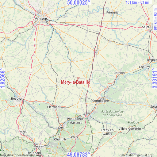
Méry-la-Bataille GPS coordinates[2]
49° 32' 46.212" North, 2° 37' 43.608" East
| Map corner | latitude | longitude |
|---|---|---|
| Upper-left | 50.00025°, | 1.92566° |
| Center: | 49.54617°, | 2.62878° |
| Lower-right: | 49.08783°, | 3.33191° |
| Map W x H: | 101.5×101.5 km | = 63.1×63.1mi |
| max Lat: | 51.07786° ⇑10% North |
| Méry-la-Bataille: | 49.54617° |
| min Lat: | ⇓90% South 41.3874° |
| min Long | Méry-la-Batail | max Long |
| -5.08615° | 2.62878° | 9.52242° |
| W 52.5%⇐ | ⇒47.5% E |
Elevation
Elevation of Méry-la-Bataille is 124 m = 407 ft, and this is 69.7 m = 229 ft below average elevation for this country.
| Max E: |
2333 m = 7654 ft | 52.3% |
| Avg. | 193.7 m = 635 ft | |
| Méry-la-Bataille | 124 m = 407 ft | |
Min E: |
-1 m = -3 ft | 47.7% |
See also: France elevation on elevation.city.
Geographical zone
Méry-la-Bataille is located in North temperate zone (between Tropic of Cancer and the Arctic Circle). Distance of this North polar circle is 1892.2 km =1175.8 mi to North.| Distance of | km | miles | from Méry-la-Bataille |
|---|---|---|---|
| North Pole | 4498 | 2794.9 | to North |
| Arctic Circle | 1892.2 | 1175.8 | to North |
| Tropic Cancer | 2903.1 | 1803.9 | to South |
| Equator | 5509 | 3423.1 | to South |


Nearby cities:
15 places around Méry-la-Bataille: (largest is in red/bold)
• Conchy-les-Pots
9.3 km =5.8 mi,  47°
47°
• Cuvilly
4.8 km =3 mi,  79°
79°
• Francières
11.4 km =7.1 mi,  161°
161°
• Gournay-sur-Aronde
6.9 km =4.3 mi,  150°
150°
• La Neuville-Roy
7.7 km =4.8 mi,  205°
205°
• Maignelay-Montigny
8.1 km =5 mi,  273°
273°
• Mareuil-la-Motte
11.6 km =7.2 mi,  90°
90°
• Monchy-Humières
12.1 km =7.5 mi,  133°
133°
• Montdidier
12.1 km =7.5 mi,  339°
339°
• Moyenneville
6.2 km =3.9 mi,  175°
175°
• Orvillers-Sorel
6.8 km =4.2 mi,  58°
58°
• Ravenel
9.8 km =6.1 mi,  249°
249°
• Ressons-sur-Matz
8.4 km =5.2 mi,  95°
95°
• Rollot
5.3 km =3.3 mi,  20°
20°
• Tricot
3.4 km =2.1 mi,  298°
298°
Sources, notices
• [Note1] Compared only with cities in France existing in our database
• [Src1] Map data: © OpenStreetMap contributors (CC-BY-SA)
• [Src2] Other city data from geonames.org with taken over terms of usage.
• [Src3] Geographical zone / Annual Mean Temperature by Robert A. Rohde @ Wikipedia
