Gondeville geodata
Gondeville (Nouvelle-Aquitaine) is a populated place; located in France in Europe/Paris (GMT+2) time zone. With population of 535 people, there are 14511 cities with bigger population in this country. Compared to other cities in France, 71.4% of cities are located further ↑North; 79.2% of cities are located further →East and 95.7% of cities have higher elevation than Gondeville. Note1
Administrative division(s):
- Level 1: Nouvelle-Aquitaine
- Level 2: Charente
- Level 3: Arrondissement de Cognac
- Level 4: Mainxe-Gondeville


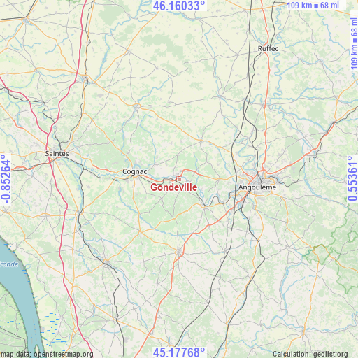
Gondeville GPS coordinates[2]
45° 40' 16.176" North, 0° 8' 58.272" West
| Map corner | latitude | longitude |
|---|---|---|
| Upper-left | 46.16033°, | -0.85264° |
| Center: | 45.67116°, | -0.14952° |
| Lower-right: | 45.17768°, | 0.55361° |
| Map W x H: | 109.3×109.3 km | = 67.9×67.9mi |
| max Lat: | 51.07786° ⇑71.4% North |
| Gondeville: | 45.67116° |
| min Lat: | ⇓28.6% South 41.3874° |
| min Long | Gondeville | max Long |
| -5.08615° | -0.14952° | 9.52242° |
| W 20.8%⇐ | ⇒79.2% E |
Elevation
Elevation of Gondeville is 15 m = 49 ft, and this is 178.7 m = 586 ft below average elevation for this country.
| Max E: |
2333 m = 7654 ft | 95.7% |
| Avg. | 193.7 m = 635 ft | |
| Gondeville | 15 m = 49 ft | |
Min E: |
-1 m = -3 ft | 4.3% |
See also: France elevation on elevation.city.
Geographical zone
Gondeville is located in North temperate zone (between Tropic of Cancer and the Arctic Circle). Distance of this North polar circle is 2323 km =1443.4 mi to North.| Distance of | km | miles | from Gondeville |
|---|---|---|---|
| North Pole | 4928.9 | 3062.7 | to North |
| Arctic Circle | 2323 | 1443.4 | to North |
| Tropic Cancer | 2472.2 | 1536.2 | to South |
| Equator | 5078.2 | 3155.4 | to South |


Nearby cities:
15 places around Gondeville: (largest is in red/bold)
• Bourg-Charente
6.5 km =4 mi,  265°
265°
• Chassors
6.1 km =3.8 mi,  301°
301°
• Châteauneuf-sur-Charente
11.1 km =6.9 mi,  135°
135°
• Courbillac
11 km =6.8 mi,  347°
347°
• Foussignac
5.7 km =3.5 mi,  26°
26°
• Gensac-la-Pallue
8.2 km =5.1 mi,  253°
253°
• Jarnac
2.2 km =1.4 mi, 302°
• Mainxe
5 km =3.1 mi,  211°
211°
• Moulidars
9 km =5.6 mi,  93°
93°
• Nercillac
9.3 km =5.8 mi, 302°
• Réparsac
9.4 km =5.8 mi,  313°
313°
• Saint-Brice
10.5 km =6.5 mi,  277°
277°
• Saint-Même-les-Carrières
2.4 km =1.5 mi,  180°
180°
• Segonzac
8 km =5 mi,  220°
220°
• Sigogne
7.3 km =4.5 mi, 354°
Sources, notices
• [Note1] Compared only with cities in France existing in our database
• [Src1] Map data: © OpenStreetMap contributors (CC-BY-SA)
• [Src2] Other city data from geonames.org with taken over terms of usage.
• [Src3] Geographical zone / Annual Mean Temperature by Robert A. Rohde @ Wikipedia
