Foussignac geodata
Foussignac (Nouvelle-Aquitaine) is a populated place; located in France in Europe/Paris (GMT+2) time zone. With population of 565 people, there are 13917 cities with bigger population in this country. Compared to other cities in France, 70.6% of cities are located further ↑North; 79% of cities are located further →East and 69.2% of cities have higher elevation than Foussignac. Note1
Administrative division(s):
- Level 1: Nouvelle-Aquitaine
- Level 2: Charente
- Level 3: Arrondissement de Cognac
- Level 4: Foussignac


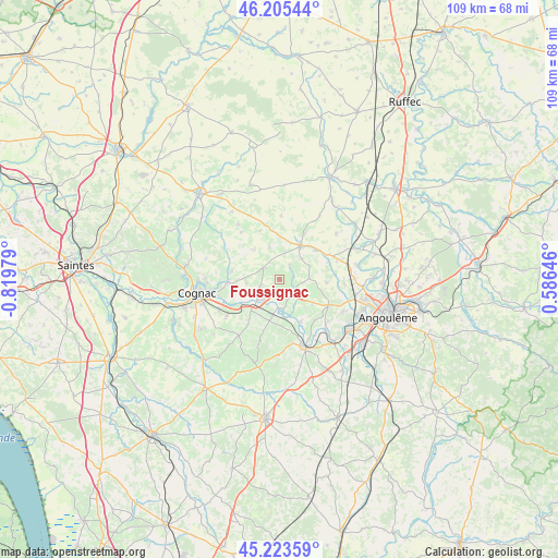
Foussignac GPS coordinates[2]
45° 43' 0.012" North, 0° 7' 0.012" West
| Map corner | latitude | longitude |
|---|---|---|
| Upper-left | 46.20544°, | -0.81979° |
| Center: | 45.71667°, | -0.11667° |
| Lower-right: | 45.22359°, | 0.58646° |
| Map W x H: | 109.2×109.2 km | = 67.9×67.9mi |
| max Lat: | 51.07786° ⇑70.6% North |
| Foussignac: | 45.71667° |
| min Lat: | ⇓29.4% South 41.3874° |
| min Long | Foussignac | max Long |
| -5.08615° | -0.11667° | 9.52242° |
| W 21%⇐ | ⇒79% E |
Elevation
Elevation of Foussignac is 80 m = 262 ft, and this is 113.7 m = 373 ft below average elevation for this country.
| Max E: |
2333 m = 7654 ft | 69.2% |
| Avg. | 193.7 m = 635 ft | |
| Foussignac | 80 m = 262 ft | |
Min E: |
-1 m = -3 ft | 30.8% |
See also: France elevation on elevation.city.
Geographical zone
Foussignac is located in North temperate zone (between Tropic of Cancer and the Arctic Circle). Distance of this North polar circle is 2318 km =1440.3 mi to North.| Distance of | km | miles | from Foussignac |
|---|---|---|---|
| North Pole | 4923.8 | 3059.5 | to North |
| Arctic Circle | 2318 | 1440.3 | to North |
| Tropic Cancer | 2477.3 | 1539.3 | to South |
| Equator | 5083.2 | 3158.6 | to South |


Nearby cities:
15 places around Foussignac: (largest is in red/bold)
• Bourg-Charente
10.6 km =6.6 mi,  238°
238°
• Chassors
8 km =5 mi,  256°
256°
• Courbillac
7.5 km =4.7 mi,  318°
318°
• Gondeville
5.7 km =3.5 mi,  206°
206°
• Hiersac
10.6 km =6.6 mi,  121°
121°
• Jarnac
5.9 km =3.7 mi,  228°
228°
• Mainxe
10.6 km =6.6 mi, 209°
• Moulidars
8.5 km =5.3 mi,  130°
130°
• Nercillac
10.4 km =6.5 mi,  270°
270°
• Rouillac
7.8 km =4.8 mi,  31°
31°
• Réparsac
9.4 km =5.8 mi,  278°
278°
• Saint-Cybardeaux
8.9 km =5.5 mi,  49°
49°
• Saint-Même-les-Carrières
7.9 km =4.9 mi,  199°
199°
• Sainte-Sévère
10.3 km =6.4 mi,  292°
292°
• Sigogne
3.9 km =2.4 mi,  304°
304°
Sources, notices
• [Note1] Compared only with cities in France existing in our database
• [Src1] Map data: © OpenStreetMap contributors (CC-BY-SA)
• [Src2] Other city data from geonames.org with taken over terms of usage.
• [Src3] Geographical zone / Annual Mean Temperature by Robert A. Rohde @ Wikipedia
