Gilly-sur-Isère geodata
Gilly-sur-Isère (Auvergne-Rhône-Alpes) is a populated place; located in France in Europe/Paris (GMT+2) time zone. With population of 2,736 people, there are 3582 cities with bigger population in this country. Compared to other cities in France, 71.6% of cities are located further ↑North; 90.7% of cities are located further ←West and 84.6% of cities have lower elevation than Gilly-sur-Isère. Note1
Administrative division(s):
- Level 1: Auvergne-Rhône-Alpes
- Level 2: Savoie
- Level 3: Albertville
- Level 4: Gilly-sur-Isère


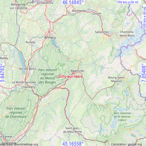
Gilly-sur-Isère GPS coordinates[2]
45° 39' 33.012" North, 6° 21' 3.456" East
| Map corner | latitude | longitude |
|---|---|---|
| Upper-left | 46.14845°, | 5.64783° |
| Center: | 45.65917°, | 6.35096° |
| Lower-right: | 45.16558°, | 7.05408° |
| Map W x H: | 109.3×109.3 km | = 67.9×67.9mi |
| max Lat: | 51.07786° ⇑71.6% North |
| Gilly-sur-Isère: | 45.65917° |
| min Lat: | ⇓28.4% South 41.3874° |
| min Long | Gilly-sur-Isèr | max Long |
| -5.08615° | 6.35096° | 9.52242° |
| W 90.7%⇐ | ⇒9.3% E |
Elevation
Elevation of Gilly-sur-Isère is 341 m = 1119 ft, and this is 147.3 m = 483 ft above average elevation for this country.
| Max E: |
2333 m = 7654 ft | 15.4% |
| Gilly-sur-Isère | 341 m 1119 ft | |
| Avg. | 193.7 m = 635 ft | |
Min E: |
-1 m = -3 ft | 84.6% |
See also: France elevation on elevation.city.
Geographical zone
Gilly-sur-Isère is located in North temperate zone (between Tropic of Cancer and the Arctic Circle). Distance of this North polar circle is 2324.4 km =1444.3 mi to North.| Distance of | km | miles | from Gilly-sur-Isère |
|---|---|---|---|
| North Pole | 4930.2 | 3063.5 | to North |
| Arctic Circle | 2324.4 | 1444.3 | to North |
| Tropic Cancer | 2470.9 | 1535.3 | to South |
| Equator | 5076.8 | 3154.6 | to South |


Nearby cities:
15 places around Gilly-sur-Isère: (largest is in red/bold)
• Albertville
3.5 km =2.2 mi,  61°
61°
• Esserts-Blay
8.3 km =5.2 mi,  127°
127°
• Frontenex
4.2 km =2.6 mi,  226°
226°
• Grignon
2.3 km =1.4 mi,  112°
112°
• La Bâthie
8.4 km =5.2 mi, 114°
• Mercury
2 km =1.2 mi,  327°
327°
• Montailleur
7.4 km =4.6 mi, 230°
• Notre-Dame-des-Millières
4.2 km =2.6 mi,  194°
194°
• Pallud
4.1 km =2.5 mi,  46°
46°
• Saint-Vital
5.3 km =3.3 mi, 229°
• Sainte-Hélène-sur-Isère
5.5 km =3.4 mi,  205°
205°
• Seythenex
8.5 km =5.3 mi, 331°
• Tours-en-Savoie
7 km =4.3 mi,  95°
95°
• Venthon
5.5 km =3.4 mi, 56°
• Verrens
2.6 km =1.6 mi,  260°
260°
Sources, notices
• [Note1] Compared only with cities in France existing in our database
• [Src1] Map data: © OpenStreetMap contributors (CC-BY-SA)
• [Src2] Other city data from geonames.org with taken over terms of usage.
• [Src3] Geographical zone / Annual Mean Temperature by Robert A. Rohde @ Wikipedia
