Gagnac-sur-Garonne geodata
Gagnac-sur-Garonne (Occitanie) is a populated place; located in France in Europe/Paris (GMT+2) time zone. With population of 1,832 people, there are 5177 cities with bigger population in this country. Compared to other cities in France, 90.4% of cities are located further ↑North; 64.6% of cities are located further →East and 53.1% of cities have higher elevation than Gagnac-sur-Garonne. Note1
Administrative division(s):
- Level 1: Occitanie
- Level 2: Haute-Garonne
- Level 3: Arrondissement de Toulouse
- Level 4: Gagnac-sur-Garonne


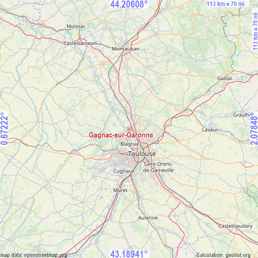
Gagnac-sur-Garonne GPS coordinates[2]
43° 41' 59.64" North, 1° 22' 31.26" East
| Map corner | latitude | longitude |
|---|---|---|
| Upper-left | 44.20608°, | 0.67222° |
| Center: | 43.6999°, | 1.37535° |
| Lower-right: | 43.18941°, | 2.07848° |
| Map W x H: | 113×113 km | = 70.2×70.2mi |
| max Lat: | 51.07786° ⇑90.4% North |
| Gagnac-sur-Garonne: | 43.6999° |
| min Lat: | ⇓9.6% South 41.3874° |
| min Long | Gagnac-sur-Garo | max Long |
| -5.08615° | 1.37535° | 9.52242° |
| W 35.4%⇐ | ⇒64.6% E |
Elevation
Elevation of Gagnac-sur-Garonne is 122 m = 400 ft, and this is 71.7 m = 235 ft below average elevation for this country.
| Max E: |
2333 m = 7654 ft | 53.1% |
| Avg. | 193.7 m = 635 ft | |
| Gagnac-sur-Garonne | 122 m = 400 ft | |
Min E: |
-1 m = -3 ft | 46.9% |
See also: France elevation on elevation.city.
Geographical zone
Gagnac-sur-Garonne is located in North temperate zone (between Tropic of Cancer and the Arctic Circle). Distance of this Northern Tropic circle is 2253.1 km =1400 mi to South.| Distance of | km | miles | from Gagnac-sur-Garonne |
|---|---|---|---|
| North Pole | 5148.1 | 3198.9 | to North |
| Arctic Circle | 2542.2 | 1579.6 | to North |
| Tropic Cancer | 2253.1 | 1400 | to South |
| Equator | 4859 | 3019.2 | to South |


Nearby cities:
15 places around Gagnac-sur-Garonne: (largest is in red/bold)
• Aucamville
5.4 km =3.4 mi,  127°
127°
• Aussonne
5 km =3.1 mi,  245°
245°
• Beauzelle
3.6 km =2.2 mi,  180°
180°
• Bruguières
4 km =2.5 mi,  40°
40°
• Castelginest
4.8 km =3 mi,  98°
98°
• Fenouillet
2.5 km =1.6 mi,  148°
148°
• Fonbeauzard
5.3 km =3.3 mi,  116°
116°
• Gratentour
5.3 km =3.3 mi,  60°
60°
• Launaguet
6.9 km =4.3 mi,  110°
110°
• Lespinasse
1.5 km =0.9 mi,  28°
28°
• Merville
6.9 km =4.3 mi,  292°
292°
• Saint-Alban
2.9 km =1.8 mi, 105°
• Saint-Jory
4.6 km =2.9 mi,  355°
355°
• Saint-Sauveur
5.8 km =3.6 mi,  20°
20°
• Seilh
1.7 km =1.1 mi, 250°
Sources, notices
• [Note1] Compared only with cities in France existing in our database
• [Src1] Map data: © OpenStreetMap contributors (CC-BY-SA)
• [Src2] Other city data from geonames.org with taken over terms of usage.
• [Src3] Geographical zone / Annual Mean Temperature by Robert A. Rohde @ Wikipedia
