Fontaine-lès-Dijon geodata
Fontaine-lès-Dijon (Bourgogne-Franche-Comté) is a populated place; located in France in Europe/Paris (GMT+2) time zone. With population of 9,234 people, there are 1040 cities with bigger population in this country. Compared to other cities in France, 50.9% of cities are located further ↑North; 77.9% of cities are located further ←West and 80.3% of cities have lower elevation than Fontaine-lès-Dijon. Note1
Administrative division(s):
- Level 1: Bourgogne-Franche-Comté
- Level 2: Département de la Côte-d'Or
- Level 3: Arrondissement de Dijon
- Level 4: Fontaine-lès-Dijon


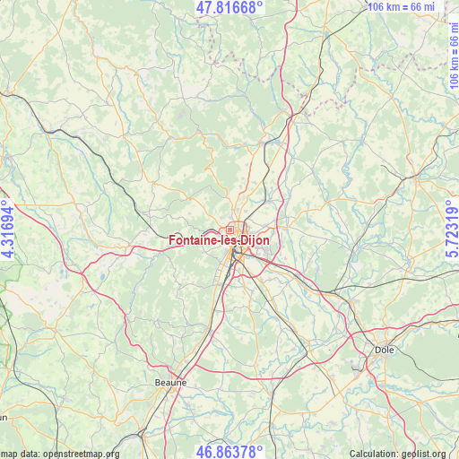
Fontaine-lès-Dijon GPS coordinates[2]
47° 20' 32.568" North, 5° 1' 12.252" East
| Map corner | latitude | longitude |
|---|---|---|
| Upper-left | 47.81668°, | 4.31694° |
| Center: | 47.34238°, | 5.02007° |
| Lower-right: | 46.86378°, | 5.72319° |
| Map W x H: | 106×106 km | = 65.9×65.9mi |
| max Lat: | 51.07786° ⇑50.9% North |
| Fontaine-lès-Dijon: | 47.34238° |
| min Lat: | ⇓49.1% South 41.3874° |
| min Long | Fontaine-lès-D | max Long |
| -5.08615° | 5.02007° | 9.52242° |
| W 77.9%⇐ | ⇒22.1% E |
Elevation
Elevation of Fontaine-lès-Dijon is 293 m = 961 ft, and this is 99.3 m = 326 ft above average elevation for this country.
| Max E: |
2333 m = 7654 ft | 19.7% |
| Fontaine-lès-Dijon | 293 m 961 ft | |
| Avg. | 193.7 m = 635 ft | |
Min E: |
-1 m = -3 ft | 80.3% |
See also: France elevation on elevation.city.
Geographical zone
Fontaine-lès-Dijon is located in North temperate zone (between Tropic of Cancer and the Arctic Circle). Distance of this North polar circle is 2137.2 km =1328 mi to North.| Distance of | km | miles | from Fontaine-lès-Dijon |
|---|---|---|---|
| North Pole | 4743.1 | 2947.2 | to North |
| Arctic Circle | 2137.2 | 1328 | to North |
| Tropic Cancer | 2658.1 | 1651.7 | to South |
| Equator | 5264 | 3270.9 | to South |


Nearby cities:
15 places around Fontaine-lès-Dijon: (largest is in red/bold)
• Ahuy
3 km =1.9 mi,  1°
1°
• Asnières-lès-Dijon
4.7 km =2.9 mi,  12°
12°
• Bellefond
5.5 km =3.4 mi,  41°
41°
• Chenôve
5.6 km =3.5 mi,  192°
192°
• Corcelles-les-Monts
8 km =5 mi,  228°
228°
• Daix
1.7 km =1.1 mi,  302°
302°
• Dijon
2.9 km =1.8 mi, 185°
• Hauteville-lès-Dijon
3.3 km =2.1 mi,  322°
322°
• Longvic
6.9 km =4.3 mi,  151°
151°
• Messigny-et-Vantoux
7.2 km =4.5 mi,  358°
358°
• Plombières-lès-Dijon
4.1 km =2.5 mi,  255°
255°
• Quetigny
7.8 km =4.8 mi,  111°
111°
• Ruffey-lès-Echirey
5.5 km =3.4 mi,  60°
60°
• Saint-Apollinaire
4.9 km =3 mi,  101°
101°
• Talant
1 km =0.6 mi, 234°
Sources, notices
• [Note1] Compared only with cities in France existing in our database
• [Src1] Map data: © OpenStreetMap contributors (CC-BY-SA)
• [Src2] Other city data from geonames.org with taken over terms of usage.
• [Src3] Geographical zone / Annual Mean Temperature by Robert A. Rohde @ Wikipedia
