Chenôve geodata
Chenôve (Bourgogne-Franche-Comté) is a populated place; located in France in Europe/Paris (GMT+2) time zone. With population of 15,791 people, there are 607 cities with bigger population in this country. Compared to other cities in France, 51.6% of cities are located further ↑North; 77.7% of cities are located further ←West and 77.3% of cities have lower elevation than Chenôve. Note1
Administrative division(s):
- Level 1: Bourgogne-Franche-Comté
- Level 2: Département de la Côte-d'Or
- Level 3: Arrondissement de Dijon
- Level 4: Chenôve


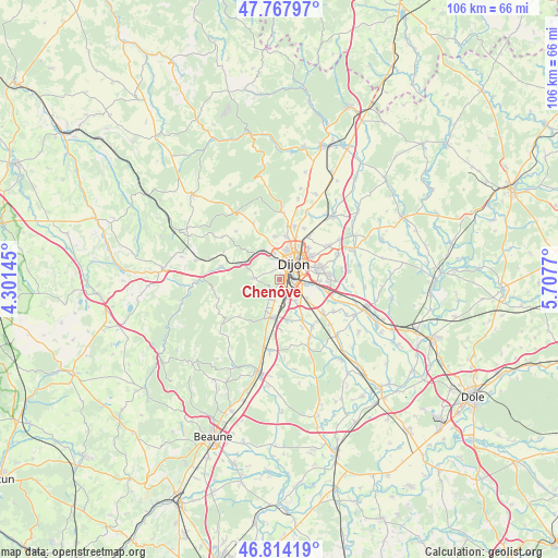
Chenôve GPS coordinates[2]
47° 17' 35.628" North, 5° 0' 16.452" East
| Map corner | latitude | longitude |
|---|---|---|
| Upper-left | 47.76797°, | 4.30145° |
| Center: | 47.29323°, | 5.00457° |
| Lower-right: | 46.81419°, | 5.7077° |
| Map W x H: | 106.1×10⁶ km | = 65.9×65.9mi |
| max Lat: | 51.07786° ⇑51.6% North |
| Chenôve: | 47.29323° |
| min Lat: | ⇓48.4% South 41.3874° |
| min Long | Chenôve | max Long |
| -5.08615° | 5.00457° | 9.52242° |
| W 77.7%⇐ | ⇒22.3% E |
Elevation
Elevation of Chenôve is 266 m = 873 ft, and this is 72.3 m = 237 ft above average elevation for this country.
| Max E: |
2333 m = 7654 ft | 22.7% |
| Chenôve | 266 m 873 ft | |
| Avg. | 193.7 m = 635 ft | |
Min E: |
-1 m = -3 ft | 77.3% |
See also: France elevation on elevation.city.
Geographical zone
Chenôve is located in North temperate zone (between Tropic of Cancer and the Arctic Circle). Distance of this North polar circle is 2142.7 km =1331.4 mi to North.| Distance of | km | miles | from Chenôve |
|---|---|---|---|
| North Pole | 4748.5 | 2950.6 | to North |
| Arctic Circle | 2142.7 | 1331.4 | to North |
| Tropic Cancer | 2652.6 | 1648.2 | to South |
| Equator | 5258.5 | 3267.5 | to South |


Nearby cities:
15 places around Chenôve: (largest is in red/bold)
• Brochon
6.7 km =4.2 mi,  203°
203°
• Corcelles-les-Monts
4.8 km =3 mi,  272°
272°
• Couchey
4.1 km =2.5 mi, 204°
• Daix
6.4 km =4 mi,  357°
357°
• Dijon
2.8 km =1.7 mi,  19°
19°
• Fixin
5.8 km =3.6 mi, 203°
• Fontaine-lès-Dijon
5.6 km =3.5 mi,  12°
12°
• Longvic
4.5 km =2.8 mi,  98°
98°
• Marsannay-la-Côte
2.7 km =1.7 mi,  205°
205°
• Ouges
6.3 km =3.9 mi,  123°
123°
• Perrigny-lès-Dijon
3 km =1.9 mi,  177°
177°
• Plombières-lès-Dijon
5.3 km =3.3 mi,  327°
327°
• Saint-Apollinaire
7.4 km =4.6 mi,  53°
53°
• Sennecey-lès-Dijon
7.6 km =4.7 mi,  92°
92°
• Talant
4.9 km =3 mi,  3°
3°
Sources, notices
• [Note1] Compared only with cities in France existing in our database
• [Src1] Map data: © OpenStreetMap contributors (CC-BY-SA)
• [Src2] Other city data from geonames.org with taken over terms of usage.
• [Src3] Geographical zone / Annual Mean Temperature by Robert A. Rohde @ Wikipedia
