Fontaine-Française geodata
Fontaine-Française (Bourgogne-Franche-Comté) is a populated place; located in France in Europe/Paris (GMT+2) time zone. With population of 936 people, there are 9332 cities with bigger population in this country. Compared to other cities in France, 51.4% of cities are located further ↓South; 81.4% of cities are located further ←West and 70.1% of cities have lower elevation than Fontaine-Française. Note1
Administrative division(s):
- Level 1: Bourgogne-Franche-Comté
- Level 2: Département de la Côte-d'Or
- Level 3: Arrondissement de Dijon
- Level 4: Fontaine-Française


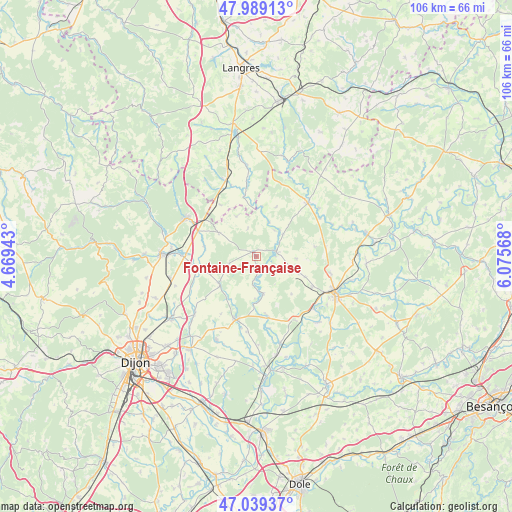
Fontaine-Française GPS coordinates[2]
47° 30' 59.04" North, 5° 22' 21.18" East
| Map corner | latitude | longitude |
|---|---|---|
| Upper-left | 47.98913°, | 4.66943° |
| Center: | 47.5164°, | 5.37255° |
| Lower-right: | 47.03937°, | 6.07568° |
| Map W x H: | 105.6×105.6 km | = 65.6×65.6mi |
| max Lat: | 51.07786° ⇑48.6% North |
| Fontaine-Française: | 47.5164° |
| min Lat: | ⇓51.4% South 41.3874° |
| min Long | Fontaine-Franç | max Long |
| -5.08615° | 5.37255° | 9.52242° |
| W 81.4%⇐ | ⇒18.6% E |
Elevation
Elevation of Fontaine-Française is 220 m = 722 ft, and this is 26.3 m = 86 ft above average elevation for this country.
| Max E: |
2333 m = 7654 ft | 29.9% |
| Fontaine-Française | 220 m 722 ft | |
| Avg. | 193.7 m = 635 ft | |
Min E: |
-1 m = -3 ft | 70.1% |
See also: France elevation on elevation.city.
Geographical zone
Fontaine-Française is located in North temperate zone (between Tropic of Cancer and the Arctic Circle). Distance of this North polar circle is 2117.8 km =1315.9 mi to North.| Distance of | km | miles | from Fontaine-Française |
|---|---|---|---|
| North Pole | 4723.7 | 2935.2 | to North |
| Arctic Circle | 2117.8 | 1315.9 | to North |
| Tropic Cancer | 2677.4 | 1663.7 | to South |
| Equator | 5283.3 | 3282.9 | to South |


Nearby cities:
15 places around Fontaine-Française: (largest is in red/bold)
• Arc-lès-Gray
17.3 km =10.7 mi,  112°
112°
• Beire-le-Châtel
17 km =10.6 mi,  227°
227°
• Bèze
9.3 km =5.8 mi, 234°
• Champlitte
15.5 km =9.6 mi,  44°
44°
• Champlitte-la-Ville
16.1 km =10 mi,  47°
47°
• Chargey-lès-Gray
15.9 km =9.9 mi,  102°
102°
• Gray-la-Ville
17.3 km =10.7 mi,  119°
119°
• Lux
12.6 km =7.8 mi,  256°
256°
• Mantoche
16.1 km =10 mi,  132°
132°
• Marcilly-sur-Tille
18.2 km =11.3 mi,  270°
270°
• Mirebeau-sur-Bèze
13.7 km =8.5 mi,  196°
196°
• Nantilly
13.3 km =8.3 mi, 119°
• Selongey
16.2 km =10.1 mi,  299°
299°
• Til-Châtel
14.9 km =9.3 mi, 269°
• Vaux-sous-Aubigny
16.7 km =10.4 mi,  337°
337°
Sources, notices
• [Note1] Compared only with cities in France existing in our database
• [Src1] Map data: © OpenStreetMap contributors (CC-BY-SA)
• [Src2] Other city data from geonames.org with taken over terms of usage.
• [Src3] Geographical zone / Annual Mean Temperature by Robert A. Rohde @ Wikipedia
