Champlitte geodata
Champlitte (Bourgogne-Franche-Comté) is a populated place; located in France in Europe/Paris (GMT+2) time zone. With population of 1,848 people, there are 5131 cities with bigger population in this country. Compared to other cities in France, 52.9% of cities are located further ↓South; 83% of cities are located further ←West and 70.4% of cities have lower elevation than Champlitte. Note1
Administrative division(s):
- Level 1: Bourgogne-Franche-Comté
- Level 2: Département de la Haute-Saône
- Level 3: Arrondissement de Vesoul
- Level 4: Champlitte


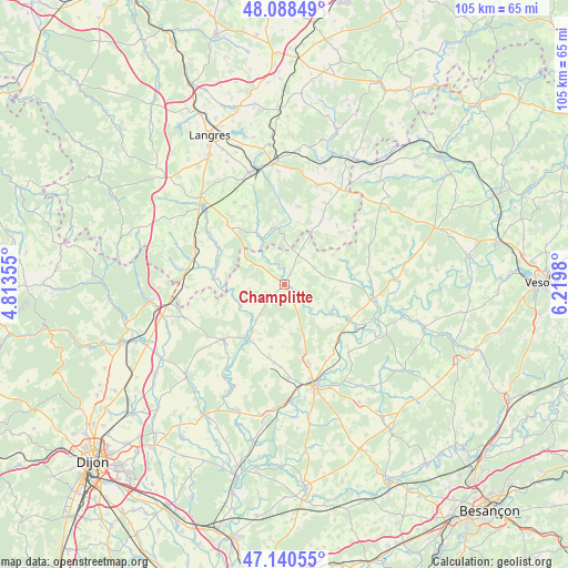
Champlitte GPS coordinates[2]
47° 37' 0.012" North, 5° 31' 0.012" East
| Map corner | latitude | longitude |
|---|---|---|
| Upper-left | 48.08849°, | 4.81355° |
| Center: | 47.61667°, | 5.51667° |
| Lower-right: | 47.14055°, | 6.2198° |
| Map W x H: | 105.4×105.4 km | = 65.5×65.5mi |
| max Lat: | 51.07786° ⇑47.1% North |
| Champlitte: | 47.61667° |
| min Lat: | ⇓52.9% South 41.3874° |
| min Long | Champlitte | max Long |
| -5.08615° | 5.51667° | 9.52242° |
| W 83%⇐ | ⇒17% E |
Elevation
Elevation of Champlitte is 221 m = 725 ft, and this is 27.3 m = 90 ft above average elevation for this country.
| Max E: |
2333 m = 7654 ft | 29.6% |
| Champlitte | 221 m 725 ft | |
| Avg. | 193.7 m = 635 ft | |
Min E: |
-1 m = -3 ft | 70.4% |
See also: France elevation on elevation.city.
Geographical zone
Champlitte is located in North temperate zone (between Tropic of Cancer and the Arctic Circle). Distance of this North polar circle is 2106.7 km =1309 mi to North.| Distance of | km | miles | from Champlitte |
|---|---|---|---|
| North Pole | 4712.6 | 2928.3 | to North |
| Arctic Circle | 2106.7 | 1309 | to North |
| Tropic Cancer | 2688.6 | 1670.6 | to South |
| Equator | 5294.5 | 3289.8 | to South |


Nearby cities:
15 places around Champlitte: (largest is in red/bold)
• Arc-lès-Gray
18.5 km =11.5 mi,  163°
163°
• Beaujeu-Saint-Vallier-Pierrejux-et-Quitteur
18 km =11.2 mi,  136°
136°
• Chalindrey
21.8 km =13.5 mi,  342°
342°
• Champlitte-la-Ville
1.2 km =0.7 mi,  108°
108°
• Chargey-lès-Gray
15.3 km =9.5 mi, 162°
• Dampierre-sur-Salon
13.9 km =8.6 mi,  118°
118°
• Fayl-Billot
19.4 km =12.1 mi,  18°
18°
• Fontaine-Française
15.5 km =9.6 mi,  224°
224°
• Gray
19.8 km =12.3 mi, 163°
• Gray-la-Ville
20.2 km =12.6 mi,  167°
167°
• Nantilly
17.6 km =10.9 mi,  177°
177°
• Prauthoy
18.1 km =11.2 mi,  292°
292°
• Rigny
18.3 km =11.4 mi,  152°
152°
• Vaux-sous-Aubigny
17.7 km =11 mi,  284°
284°
• Villegusien-le-Lac
19.8 km =12.3 mi,  312°
312°
Sources, notices
• [Note1] Compared only with cities in France existing in our database
• [Src1] Map data: © OpenStreetMap contributors (CC-BY-SA)
• [Src2] Other city data from geonames.org with taken over terms of usage.
• [Src3] Geographical zone / Annual Mean Temperature by Robert A. Rohde @ Wikipedia
