Mantoche geodata
Mantoche (Bourgogne-Franche-Comté) is a populated place; located in France in Europe/Paris (GMT+2) time zone. With population of 527 people, there are 14675 cities with bigger population in this country. Compared to other cities in France, 50.1% of cities are located further ↓South; 83.2% of cities are located further ←West and 65.2% of cities have lower elevation than Mantoche. Note1
Administrative division(s):
- Level 1: Bourgogne-Franche-Comté
- Level 2: Département de la Haute-Saône
- Level 3: Arrondissement de Vesoul
- Level 4: Mantoche


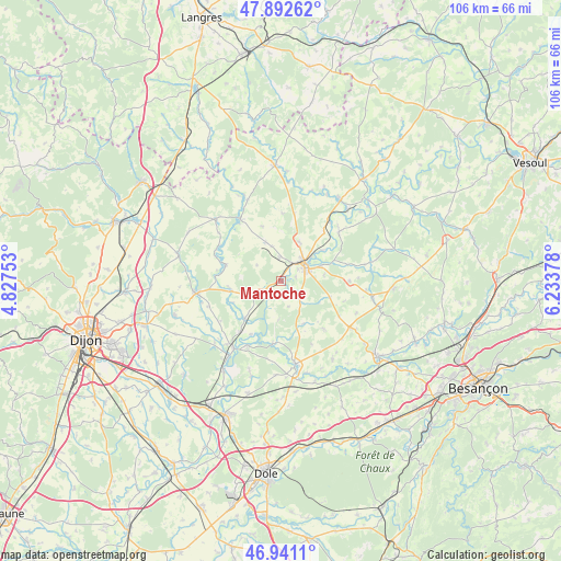
Mantoche GPS coordinates[2]
47° 25' 8.436" North, 5° 31' 50.34" East
| Map corner | latitude | longitude |
|---|---|---|
| Upper-left | 47.89262°, | 4.82753° |
| Center: | 47.41901°, | 5.53065° |
| Lower-right: | 46.9411°, | 6.23378° |
| Map W x H: | 105.8×105.8 km | = 65.7×65.7mi |
| max Lat: | 51.07786° ⇑49.9% North |
| Mantoche: | 47.41901° |
| min Lat: | ⇓50.1% South 41.3874° |
| min Long | Mantoche | max Long |
| -5.08615° | 5.53065° | 9.52242° |
| W 83.2%⇐ | ⇒16.8% E |
Elevation
Elevation of Mantoche is 195 m = 640 ft, and this is 1.3 m = 4 ft above average elevation for this country.
| Max E: |
2333 m = 7654 ft | 34.8% |
| Mantoche | 195 m 640 ft | |
| Avg. | 193.7 m = 635 ft | |
Min E: |
-1 m = -3 ft | 65.2% |
See also: France elevation on elevation.city.
Geographical zone
Mantoche is located in North temperate zone (between Tropic of Cancer and the Arctic Circle). Distance of this North polar circle is 2128.7 km =1322.7 mi to North.| Distance of | km | miles | from Mantoche |
|---|---|---|---|
| North Pole | 4734.6 | 2941.9 | to North |
| Arctic Circle | 2128.7 | 1322.7 | to North |
| Tropic Cancer | 2666.6 | 1656.9 | to South |
| Equator | 5272.5 | 3276.2 | to South |


Nearby cities:
15 places around Mantoche: (largest is in red/bold)
• Arc-lès-Gray
5.9 km =3.7 mi,  44°
44°
• Beaujeu-Saint-Vallier-Pierrejux-et-Quitteur
14.6 km =9.1 mi,  51°
51°
• Bèze
20.3 km =12.6 mi,  285°
285°
• Chargey-lès-Gray
8.2 km =5.1 mi,  26°
26°
• Dampierre-sur-Salon
19 km =11.8 mi, 36°
• Fontaine-Française
16.1 km =10 mi,  312°
312°
• Gray
5.5 km =3.4 mi,  57°
57°
• Gray-la-Ville
3.9 km =2.4 mi, 54°
• Lamarche-sur-Saône
19.9 km =12.4 mi,  213°
213°
• Mirebeau-sur-Bèze
15.9 km =9.9 mi,  261°
261°
• Nantilly
4.4 km =2.7 mi,  356°
356°
• Pesmes
15.7 km =9.8 mi,  169°
169°
• Pontailler-sur-Saône
15.4 km =9.6 mi, 214°
• Rigny
9.5 km =5.9 mi, 52°
• Valay
12.1 km =7.5 mi,  138°
138°
Sources, notices
• [Note1] Compared only with cities in France existing in our database
• [Src1] Map data: © OpenStreetMap contributors (CC-BY-SA)
• [Src2] Other city data from geonames.org with taken over terms of usage.
• [Src3] Geographical zone / Annual Mean Temperature by Robert A. Rohde @ Wikipedia
