Étouy geodata
Étouy (Hauts-de-France) is a populated place; located in France in Europe/Paris (GMT+2) time zone. With population of 809 people, there are 10494 cities with bigger population in this country. Compared to other cities in France, 88.3% of cities are located further ↓South; 51.6% of cities are located further →East and 74.6% of cities have higher elevation than Étouy. Note1
Administrative division(s):
- Level 1: Hauts-de-France
- Level 2: Département de l'Oise
- Level 3: Arrondissement de Clermont
- Level 4: Étouy


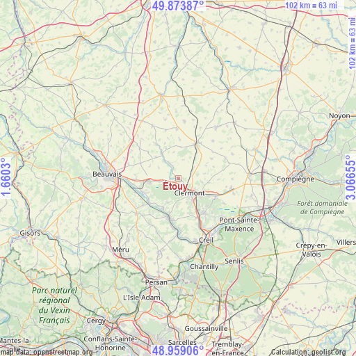
Étouy GPS coordinates[2]
49° 25' 6.96" North, 2° 21' 48.348" East
| Map corner | latitude | longitude |
|---|---|---|
| Upper-left | 49.87387°, | 1.6603° |
| Center: | 49.4186°, | 2.36343° |
| Lower-right: | 48.95906°, | 3.06655° |
| Map W x H: | 101.7×101.7 km | = 63.2×63.2mi |
| max Lat: | 51.07786° ⇑11.7% North |
| Étouy: | 49.4186° |
| min Lat: | ⇓88.3% South 41.3874° |
| min Long | Étouy | max Long |
| -5.08615° | 2.36343° | 9.52242° |
| W 48.4%⇐ | ⇒51.6% E |
Elevation
Elevation of Étouy is 68 m = 223 ft, and this is 125.7 m = 412 ft below average elevation for this country.
| Max E: |
2333 m = 7654 ft | 74.6% |
| Avg. | 193.7 m = 635 ft | |
| Étouy | 68 m = 223 ft | |
Min E: |
-1 m = -3 ft | 25.4% |
See also: France elevation on elevation.city.
Geographical zone
Étouy is located in North temperate zone (between Tropic of Cancer and the Arctic Circle). Distance of this North polar circle is 1906.3 km =1184.5 mi to North.| Distance of | km | miles | from Étouy |
|---|---|---|---|
| North Pole | 4512.2 | 2803.8 | to North |
| Arctic Circle | 1906.3 | 1184.5 | to North |
| Tropic Cancer | 2888.9 | 1795.1 | to South |
| Equator | 5494.8 | 3414.3 | to South |


Nearby cities:
15 places around Étouy: (largest is in red/bold)
• Agnetz
4.5 km =2.8 mi,  158°
158°
• Airion
4 km =2.5 mi,  79°
79°
• Avrechy
5.6 km =3.5 mi,  54°
54°
• Bresles
8.2 km =5.1 mi,  263°
263°
• Breuil-le-Sec
8.2 km =5.1 mi,  129°
129°
• Breuil-le-Vert
8.2 km =5.1 mi,  140°
140°
• Bulles
5.3 km =3.3 mi,  329°
329°
• Clermont
5.7 km =3.5 mi, 141°
• Erquery
6.9 km =4.3 mi,  99°
99°
• Fitz-James
5.7 km =3.5 mi,  122°
122°
• Fournival
5.5 km =3.4 mi,  15°
15°
• La Neuville-en-Hez
3.2 km =2 mi,  238°
238°
• La Rue-Saint-Pierre
5 km =3.1 mi, 258°
• Neuilly-sous-Clermont
8.9 km =5.5 mi, 157°
• Thury-sous-Clermont
7.2 km =4.5 mi,  200°
200°
Sources, notices
• [Note1] Compared only with cities in France existing in our database
• [Src1] Map data: © OpenStreetMap contributors (CC-BY-SA)
• [Src2] Other city data from geonames.org with taken over terms of usage.
• [Src3] Geographical zone / Annual Mean Temperature by Robert A. Rohde @ Wikipedia
