Esnandes geodata
Esnandes (Nouvelle-Aquitaine) is a populated place; located in France in Europe/Paris (GMT+2) time zone. With population of 1,959 people, there are 4883 cities with bigger population in this country. Compared to other cities in France, 62.9% of cities are located further ↑North; 89.3% of cities are located further →East and 97.8% of cities have higher elevation than Esnandes. Note1
Administrative division(s):
- Level 1: Nouvelle-Aquitaine
- Level 2: Charente-Maritime
- Level 3: Arrondissement de La Rochelle
- Level 4: Esnandes


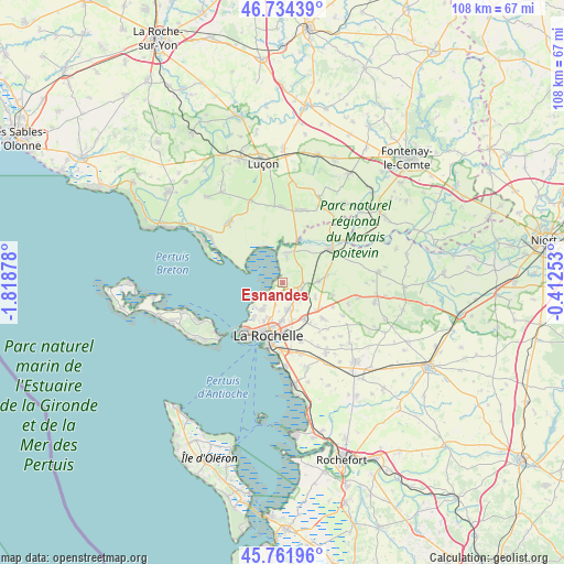
Esnandes GPS coordinates[2]
46° 15' 1.188" North, 1° 6' 56.376" West
| Map corner | latitude | longitude |
|---|---|---|
| Upper-left | 46.73439°, | -1.81878° |
| Center: | 46.25033°, | -1.11566° |
| Lower-right: | 45.76196°, | -0.41253° |
| Map W x H: | 108.1×108.1 km | = 67.2×67.2mi |
| max Lat: | 51.07786° ⇑62.9% North |
| Esnandes: | 46.25033° |
| min Lat: | ⇓37.1% South 41.3874° |
| min Long | Esnandes | max Long |
| -5.08615° | -1.11566° | 9.52242° |
| W 10.7%⇐ | ⇒89.3% E |
Elevation
Elevation of Esnandes is 9 m = 30 ft, and this is 184.7 m = 606 ft below average elevation for this country.
| Max E: |
2333 m = 7654 ft | 97.8% |
| Avg. | 193.7 m = 635 ft | |
| Esnandes | 9 m = 30 ft | |
Min E: |
-1 m = -3 ft | 2.2% |
See also: France elevation on elevation.city.
Geographical zone
Esnandes is located in North temperate zone (between Tropic of Cancer and the Arctic Circle). Distance of this North polar circle is 2258.6 km =1403.4 mi to North.| Distance of | km | miles | from Esnandes |
|---|---|---|---|
| North Pole | 4864.5 | 3022.7 | to North |
| Arctic Circle | 2258.6 | 1403.4 | to North |
| Tropic Cancer | 2536.6 | 1576.2 | to South |
| Equator | 5142.6 | 3195.5 | to South |


Nearby cities:
15 places around Esnandes: (largest is in red/bold)
• Andilly
6.9 km =4.3 mi,  86°
86°
• Bourgneuf
11.7 km =7.3 mi,  141°
141°
• Charron
5 km =3.1 mi,  8°
8°
• Dompierre-sur-Mer
8 km =5 mi,  149°
149°
• La Rochelle
9.7 km =6 mi,  195°
195°
• Lagord
7.5 km =4.7 mi, 202°
• Longèves
9.9 km =6.2 mi,  103°
103°
• Marans
11.3 km =7 mi,  55°
55°
• Marsilly
2.8 km =1.7 mi,  218°
218°
• Nieul-sur-Mer
6.2 km =3.9 mi, 217°
• Puilboreau
7.1 km =4.4 mi,  181°
181°
• Périgny
10.7 km =6.6 mi,  172°
172°
• Saint-Xandre
5.2 km =3.2 mi, 168°
• Sainte-Soulle
10.3 km =6.4 mi,  131°
131°
• Villedoux
3.9 km =2.4 mi,  105°
105°
Sources, notices
• [Note1] Compared only with cities in France existing in our database
• [Src1] Map data: © OpenStreetMap contributors (CC-BY-SA)
• [Src2] Other city data from geonames.org with taken over terms of usage.
• [Src3] Geographical zone / Annual Mean Temperature by Robert A. Rohde @ Wikipedia
