Épervans geodata
Épervans (Bourgogne-Franche-Comté) is a populated place; located in France in Europe/Paris (GMT+2) time zone. With population of 1,478 people, there are 6259 cities with bigger population in this country. Compared to other cities in France, 57.7% of cities are located further ↑North; 76.5% of cities are located further ←West and 62.5% of cities have lower elevation than Épervans. Note1
Administrative division(s):
- Level 1: Bourgogne-Franche-Comté
- Level 2: Département de Saône-et-Loire
- Level 3: Arrondissement de Chalon-sur-Saône
- Level 4: Épervans


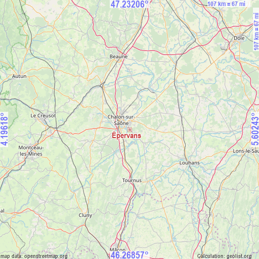
Épervans GPS coordinates[2]
46° 45' 8.892" North, 4° 53' 57.48" East
| Map corner | latitude | longitude |
|---|---|---|
| Upper-left | 47.23206°, | 4.19618° |
| Center: | 46.75247°, | 4.8993° |
| Lower-right: | 46.26857°, | 5.60243° |
| Map W x H: | 107.1×107.1 km | = 66.5×66.5mi |
| max Lat: | 51.07786° ⇑57.7% North |
| Épervans: | 46.75247° |
| min Lat: | ⇓42.3% South 41.3874° |
| min Long | Épervans | max Long |
| -5.08615° | 4.8993° | 9.52242° |
| W 76.5%⇐ | ⇒23.5% E |
Elevation
Elevation of Épervans is 182 m = 597 ft, and this is 11.7 m = 38 ft below average elevation for this country.
| Max E: |
2333 m = 7654 ft | 37.5% |
| Avg. | 193.7 m = 635 ft | |
| Épervans | 182 m = 597 ft | |
Min E: |
-1 m = -3 ft | 62.5% |
See also: France elevation on elevation.city.
Geographical zone
Épervans is located in North temperate zone (between Tropic of Cancer and the Arctic Circle). Distance of this North polar circle is 2202.8 km =1368.8 mi to North.| Distance of | km | miles | from Épervans |
|---|---|---|---|
| North Pole | 4808.7 | 2988 | to North |
| Arctic Circle | 2202.8 | 1368.8 | to North |
| Tropic Cancer | 2592.5 | 1610.9 | to South |
| Equator | 5198.4 | 3230.1 | to South |


Nearby cities:
15 places around Épervans: (largest is in red/bold)
• Allériot
7.7 km =4.8 mi,  27°
27°
• Chalon-sur-Saône
4.7 km =2.9 mi,  312°
312°
• Châtenoy-en-Bresse
4.5 km =2.8 mi,  12°
12°
• Châtenoy-le-Royal
8.4 km =5.2 mi, 307°
• Crissey
7.2 km =4.5 mi,  349°
349°
• La Charmée
8.7 km =5.4 mi,  245°
245°
• Lans
2.6 km =1.6 mi,  41°
41°
• Oslon
3.9 km =2.4 mi, 27°
• Ouroux-sur-Saône
5.3 km =3.3 mi,  130°
130°
• Saint-Christophe-en-Bresse
6.7 km =4.2 mi,  90°
90°
• Saint-Cyr
7.8 km =4.8 mi,  185°
185°
• Saint-Marcel
2.4 km =1.5 mi, 346°
• Saint-Rémy
4.7 km =2.9 mi,  284°
284°
• Sevrey
4.8 km =3 mi, 250°
• Varennes-le-Grand
4.4 km =2.7 mi,  211°
211°
Sources, notices
• [Note1] Compared only with cities in France existing in our database
• [Src1] Map data: © OpenStreetMap contributors (CC-BY-SA)
• [Src2] Other city data from geonames.org with taken over terms of usage.
• [Src3] Geographical zone / Annual Mean Temperature by Robert A. Rohde @ Wikipedia
