Saint-Christophe-en-Bresse geodata
Saint-Christophe-en-Bresse (Bourgogne-Franche-Comté) is a populated place; located in France in Europe/Paris (GMT+2) time zone. With population of 931 people, there are 9375 cities with bigger population in this country. Compared to other cities in France, 57.7% of cities are located further ↑North; 77.5% of cities are located further ←West and 64.4% of cities have lower elevation than Saint-Christophe-en-Bresse. Note1
Administrative division(s):
- Level 1: Bourgogne-Franche-Comté
- Level 2: Département de Saône-et-Loire
- Level 3: Arrondissement de Louhans
- Level 4: Saint-Christophe-en-Bresse
Current local time in Saint-Christophe-en-Bresse:
04:03 PM, SaturdayDifference from your time zone: hours


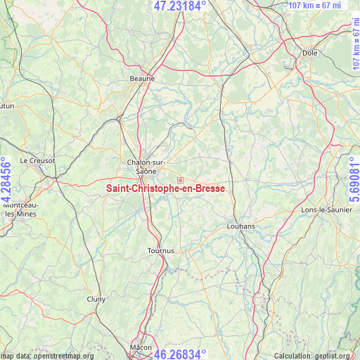
Saint-Christophe-en-Bresse GPS coordinates[2]
46° 45' 8.064" North, 4° 59' 15.684" East
| Map corner | latitude | longitude |
|---|---|---|
| Upper-left | 47.23184°, | 4.28456° |
| Center: | 46.75224°, | 4.98769° |
| Lower-right: | 46.26834°, | 5.69081° |
| Map W x H: | 107.1×107.1 km | = 66.5×66.5mi |
| max Lat: | 51.07786° ⇑57.7% North |
| Saint-Christophe-en-Bresse: | 46.75224° |
| min Lat: | ⇓42.3% South 41.3874° |
| min Long | Saint-Christoph | max Long |
| -5.08615° | 4.98769° | 9.52242° |
| W 77.5%⇐ | ⇒22.5% E |
Elevation
Elevation of Saint-Christophe-en-Bresse is 191 m = 627 ft, and this is 2.7 m = 9 ft below average elevation for this country.
| Max E: |
2333 m = 7654 ft | 35.6% |
| Avg. | 193.7 m = 635 ft | |
| Saint-Christophe-en-Bresse | 191 m = 627 ft | |
Min E: |
-1 m = -3 ft | 64.4% |
See also: France elevation on elevation.city.
Geographical zone
Saint-Christophe-en-Bresse is located in North temperate zone (between Tropic of Cancer and the Arctic Circle). Distance of this North polar circle is 2202.8 km =1368.8 mi to North.| Distance of | km | miles | from Saint-Christophe-en-Bresse |
|---|---|---|---|
| North Pole | 4808.7 | 2988 | to North |
| Arctic Circle | 2202.8 | 1368.8 | to North |
| Tropic Cancer | 2592.4 | 1610.8 | to South |
| Equator | 5198.4 | 3230.1 | to South |


Nearby cities:
15 places around Saint-Christophe-en-Bresse: (largest is in red/bold)
• Allériot
7.6 km =4.7 mi,  335°
335°
• Baudrières
9 km =5.6 mi,  168°
168°
• Bey
7.7 km =4.8 mi,  348°
348°
• Châtenoy-en-Bresse
7.2 km =4.5 mi,  307°
307°
• Damerey
9.1 km =5.7 mi,  1°
1°
• Lans
5.4 km =3.4 mi,  291°
291°
• Oslon
6 km =3.7 mi, 305°
• Ouroux-sur-Saône
4.3 km =2.7 mi,  217°
217°
• Saint-Germain-du-Plain
5.9 km =3.7 mi,  181°
181°
• Saint-Marcel
7.7 km =4.8 mi, 288°
• Saint-Martin-en-Bresse
9.1 km =5.7 mi,  37°
37°
• Saint-Étienne-en-Bresse
7 km =4.3 mi,  136°
136°
• Sassenay
9.9 km =6.2 mi,  331°
331°
• Varennes-le-Grand
9.8 km =6.1 mi,  247°
247°
• Épervans
6.7 km =4.2 mi,  270°
270°
Sources, notices
• [Note1] Compared only with cities in France existing in our database
• [Src1] Map data: © OpenStreetMap contributors (CC-BY-SA)
• [Src2] Other city data from geonames.org with taken over terms of usage.
• [Src3] Geographical zone / Annual Mean Temperature by Robert A. Rohde @ Wikipedia
