Englefontaine geodata
Englefontaine (Hauts-de-France) is a populated place; located in France in Europe/Paris (GMT+2) time zone. With population of 1,355 people, there are 6787 cities with bigger population in this country. Compared to other cities in France, 94.8% of cities are located further ↓South; 65.4% of cities are located further ←West and 53.6% of cities have lower elevation than Englefontaine. Note1
Administrative division(s):
- Level 1: Hauts-de-France
- Level 2: Nord
- Level 3: Avesnes-sur-Helpe
- Level 4: Englefontaine


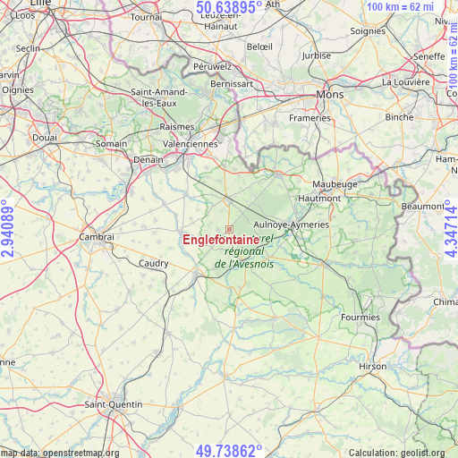
Englefontaine GPS coordinates[2]
50° 11' 27.276" North, 3° 38' 38.436" East
| Map corner | latitude | longitude |
|---|---|---|
| Upper-left | 50.63895°, | 2.94089° |
| Center: | 50.19091°, | 3.64401° |
| Lower-right: | 49.73862°, | 4.34714° |
| Map W x H: | 100.1×100.1 km | = 62.2×62.2mi |
| max Lat: | 51.07786° ⇑5.2% North |
| Englefontaine: | 50.19091° |
| min Lat: | ⇓94.8% South 41.3874° |
| min Long | Englefontaine | max Long |
| -5.08615° | 3.64401° | 9.52242° |
| W 65.4%⇐ | ⇒34.6% E |
Elevation
Elevation of Englefontaine is 145 m = 476 ft, and this is 48.7 m = 160 ft below average elevation for this country.
| Max E: |
2333 m = 7654 ft | 46.4% |
| Avg. | 193.7 m = 635 ft | |
| Englefontaine | 145 m = 476 ft | |
Min E: |
-1 m = -3 ft | 53.6% |
See also: France elevation on elevation.city.
Geographical zone
Englefontaine is located in North temperate zone (between Tropic of Cancer and the Arctic Circle). Distance of this North polar circle is 1820.5 km =1131.2 mi to North.| Distance of | km | miles | from Englefontaine |
|---|---|---|---|
| North Pole | 4426.4 | 2750.4 | to North |
| Arctic Circle | 1820.5 | 1131.2 | to North |
| Tropic Cancer | 2974.8 | 1848.5 | to South |
| Equator | 5580.7 | 3467.7 | to South |


Nearby cities:
15 places around Englefontaine: (largest is in red/bold)
• Beaudignies
6.2 km =3.9 mi,  324°
324°
• Bousies
4.8 km =3 mi,  203°
203°
• Fontaine-au-Bois
5.5 km =3.4 mi,  177°
177°
• Forest-en-Cambrésis
7.6 km =4.7 mi,  222°
222°
• Gommegnies
10 km =6.2 mi,  26°
26°
• Jolimetz
4.7 km =2.9 mi, 29°
• Landrecies
8.1 km =5 mi,  155°
155°
• Le Quesnoy
6.4 km =4 mi,  355°
355°
• Louvignies-Quesnoy
3.7 km =2.3 mi, 357°
• Poix-du-Nord
2.5 km =1.6 mi,  265°
265°
• Pommereuil
9.4 km =5.8 mi, 201°
• Preux-au-Bois
3.1 km =1.9 mi, 160°
• Ruesnes
8.7 km =5.4 mi,  330°
330°
• Vertain
8.8 km =5.5 mi,  285°
285°
• Villereau
7.4 km =4.6 mi,  11°
11°
Sources, notices
• [Note1] Compared only with cities in France existing in our database
• [Src1] Map data: © OpenStreetMap contributors (CC-BY-SA)
• [Src2] Other city data from geonames.org with taken over terms of usage.
• [Src3] Geographical zone / Annual Mean Temperature by Robert A. Rohde @ Wikipedia
