Écuires geodata
Écuires (Hauts-de-France) is a populated place; located in France in Europe/Paris (GMT+2) time zone. With population of 869 people, there are 9902 cities with bigger population in this country. Compared to other cities in France, 96.9% of cities are located further ↓South; 59.8% of cities are located further →East and 96.7% of cities have higher elevation than Écuires. Note1
Administrative division(s):
- Level 1: Hauts-de-France
- Level 2: Pas-de-Calais
- Level 3: Arrondissement de Montreuil
- Level 4: Écuires


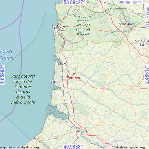
Écuires GPS coordinates[2]
50° 26' 55.176" North, 1° 45' 46.98" East
| Map corner | latitude | longitude |
|---|---|---|
| Upper-left | 50.89427°, | 1.05992° |
| Center: | 50.44866°, | 1.76305° |
| Lower-right: | 49.99881°, | 2.46617° |
| Map W x H: | 99.6×99.6 km | = 61.9×61.9mi |
| max Lat: | 51.07786° ⇑3.1% North |
| Écuires: | 50.44866° |
| min Lat: | ⇓96.9% South 41.3874° |
| min Long | Écuires | max Long |
| -5.08615° | 1.76305° | 9.52242° |
| W 40.2%⇐ | ⇒59.8% E |
Elevation
Elevation of Écuires is 12 m = 39 ft, and this is 181.7 m = 596 ft below average elevation for this country.
| Max E: |
2333 m = 7654 ft | 96.7% |
| Avg. | 193.7 m = 635 ft | |
| Écuires | 12 m = 39 ft | |
Min E: |
-1 m = -3 ft | 3.3% |
See also: France elevation on elevation.city.
Geographical zone
Écuires is located in North temperate zone (between Tropic of Cancer and the Arctic Circle). Distance of this North polar circle is 1791.8 km =1113.4 mi to North.| Distance of | km | miles | from Écuires |
|---|---|---|---|
| North Pole | 4397.7 | 2732.6 | to North |
| Arctic Circle | 1791.8 | 1113.4 | to North |
| Tropic Cancer | 3003.4 | 1866.2 | to South |
| Equator | 5609.4 | 3485.5 | to South |


Nearby cities:
15 places around Écuires: (largest is in red/bold)
• Attin
4.4 km =2.7 mi,  344°
344°
• Beaurainville
10 km =6.2 mi,  105°
105°
• Brimeux
5.1 km =3.2 mi,  96°
96°
• Bréxent-Énocq
7.2 km =4.5 mi, 341°
• Buire-le-Sec
8.7 km =5.4 mi,  145°
145°
• Campagne-lès-Hesdin
9.8 km =6.1 mi,  125°
125°
• Campigneulles-les-Petites
2.1 km =1.3 mi,  254°
254°
• La Calotterie
3.9 km =2.4 mi,  319°
319°
• Merlimont
10.6 km =6.6 mi,  274°
274°
• Montreuil
1.7 km =1.1 mi,  1°
1°
• Neuville-sous-Montreuil
3.1 km =1.9 mi,  18°
18°
• Rang-du-Fliers
9.1 km =5.7 mi, 247°
• Saint-Josse
7.5 km =4.7 mi,  286°
286°
• Verton
9.7 km =6 mi,  237°
237°
• Wailly-Beaucamp
5 km =3.1 mi,  211°
211°
Sources, notices
• [Note1] Compared only with cities in France existing in our database
• [Src1] Map data: © OpenStreetMap contributors (CC-BY-SA)
• [Src2] Other city data from geonames.org with taken over terms of usage.
• [Src3] Geographical zone / Annual Mean Temperature by Robert A. Rohde @ Wikipedia
