Dun geodata
Dun (Occitanie) is a populated place; located in France in Europe/Paris (GMT+2) time zone. With population of 518 people, there are 14866 cities with bigger population in this country. Compared to other cities in France, 98.3% of cities are located further ↑North; 59.4% of cities are located further →East and 83.7% of cities have lower elevation than Dun. Note1
Administrative division(s):
- Level 1: Occitanie
- Level 2: Département de l'Ariège
- Level 3: Arrondissement de Pamiers
- Level 4: Dun


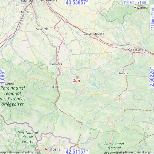
Dun GPS coordinates[2]
43° 1' 39.792" North, 1° 47' 56.868" East
| Map corner | latitude | longitude |
|---|---|---|
| Upper-left | 43.53957°, | 1.096° |
| Center: | 43.02772°, | 1.79913° |
| Lower-right: | 42.51157°, | 2.50225° |
| Map W x H: | 114.3×114.3 km | = 71×71mi |
| max Lat: | 51.07786° ⇑98.3% North |
| Dun: | 43.02772° |
| min Lat: | ⇓1.7% South 41.3874° |
| min Long | Dun | max Long |
| -5.08615° | 1.79913° | 9.52242° |
| W 40.6%⇐ | ⇒59.4% E |
Elevation
Elevation of Dun is 331 m = 1086 ft, and this is 137.3 m = 450 ft above average elevation for this country.
| Max E: |
2333 m = 7654 ft | 16.3% |
| Dun | 331 m 1086 ft | |
| Avg. | 193.7 m = 635 ft | |
Min E: |
-1 m = -3 ft | 83.7% |
See also: France elevation on elevation.city.
Geographical zone
Dun is located in North temperate zone (between Tropic of Cancer and the Arctic Circle). Distance of this Northern Tropic circle is 2178.3 km =1353.5 mi to South.| Distance of | km | miles | from Dun |
|---|---|---|---|
| North Pole | 5222.8 | 3245.3 | to North |
| Arctic Circle | 2616.9 | 1626.1 | to North |
| Tropic Cancer | 2178.3 | 1353.5 | to South |
| Equator | 4784.2 | 2972.8 | to South |


Nearby cities:
15 places around Dun: (largest is in red/bold)
• Aigues-Vives
7.1 km =4.4 mi,  120°
120°
• Dalou
12.8 km =8 mi,  273°
273°
• La Bastide-sur-l’Hers
12 km =7.5 mi,  132°
132°
• La Tour-du-Crieu
14.7 km =9.1 mi,  305°
305°
• Laroque-d’Olmes
8.6 km =5.3 mi,  140°
140°
• Lavelanet
11.4 km =7.1 mi,  160°
160°
• Les Pujols
9.4 km =5.8 mi,  315°
315°
• Léran
10.1 km =6.3 mi, 116°
• Mirepoix
9 km =5.6 mi,  42°
42°
• Montferrier
15 km =9.3 mi,  183°
183°
• Saint-Jean-de-Verges
15.4 km =9.6 mi,  264°
264°
• Saint-Jean-du-Falga
15.4 km =9.6 mi,  295°
295°
• Varilhes
14 km =8.7 mi,  277°
277°
• Verniolle
13.6 km =8.5 mi, 296°
• Villeneuve-d’Olmes
13.6 km =8.5 mi,  173°
173°
Sources, notices
• [Note1] Compared only with cities in France existing in our database
• [Src1] Map data: © OpenStreetMap contributors (CC-BY-SA)
• [Src2] Other city data from geonames.org with taken over terms of usage.
• [Src3] Geographical zone / Annual Mean Temperature by Robert A. Rohde @ Wikipedia
