Créances geodata
Créances (Normandy) is a populated place; located in France in Europe/Paris (GMT+2) time zone. With population of 2,052 people, there are 4679 cities with bigger population in this country. Compared to other cities in France, 84.3% of cities are located further ↓South; 92.7% of cities are located further →East and 96% of cities have higher elevation than Créances. Note1
Administrative division(s):
- Level 1: Normandy
- Level 2: Manche
- Level 3: Arrondissement de Coutances
- Level 4: Créances


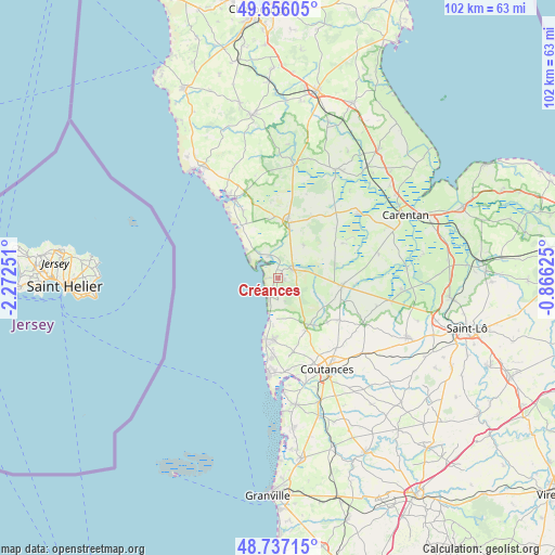
Créances GPS coordinates[2]
49° 11' 55.428" North, 1° 34' 9.768" West
| Map corner | latitude | longitude |
|---|---|---|
| Upper-left | 49.65605°, | -2.27251° |
| Center: | 49.19873°, | -1.56938° |
| Lower-right: | 48.73715°, | -0.86625° |
| Map W x H: | 102.2×102.2 km | = 63.5×63.5mi |
| max Lat: | 51.07786° ⇑15.7% North |
| Créances: | 49.19873° |
| min Lat: | ⇓84.3% South 41.3874° |
| min Long | Créances | max Long |
| -5.08615° | -1.56938° | 9.52242° |
| W 7.3%⇐ | ⇒92.7% E |
Elevation
Elevation of Créances is 14 m = 46 ft, and this is 179.7 m = 590 ft below average elevation for this country.
| Max E: |
2333 m = 7654 ft | 96% |
| Avg. | 193.7 m = 635 ft | |
| Créances | 14 m = 46 ft | |
Min E: |
-1 m = -3 ft | 4% |
See also: France elevation on elevation.city.
Geographical zone
Créances is located in North temperate zone (between Tropic of Cancer and the Arctic Circle). Distance of this North polar circle is 1930.8 km =1199.7 mi to North.| Distance of | km | miles | from Créances |
|---|---|---|---|
| North Pole | 4536.7 | 2819 | to North |
| Arctic Circle | 1930.8 | 1199.7 | to North |
| Tropic Cancer | 2864.5 | 1779.9 | to South |
| Equator | 5470.4 | 3399.1 | to South |


Nearby cities:
15 places around Créances: (largest is in red/bold)
• Blainville-sur-Mer
14.8 km =9.2 mi,  183°
183°
• Gouville-sur-Mer
11.4 km =7.1 mi, 183°
• Gratot
15.8 km =9.8 mi,  156°
156°
• La Haye-du-Puits
10.3 km =6.4 mi,  10°
10°
• Lessay
3.5 km =2.2 mi,  53°
53°
• Lithaire
12.8 km =8 mi,  29°
29°
• Millières
8 km =5 mi,  99°
99°
• Monthuchon
16.9 km =10.5 mi,  141°
141°
• Muneville-le-Bingard
10.9 km =6.8 mi, 143°
• Pirou
2 km =1.2 mi,  189°
189°
• Périers
11.8 km =7.3 mi, 96°
• Saint-Germain-sur-Ay
4.4 km =2.7 mi,  335°
335°
• Saint-Sauveur-Lendelin
13.6 km =8.5 mi,  124°
124°
• Saint-Symphorien-le-Valois
10.6 km =6.6 mi, 5°
• Vesly
7.6 km =4.7 mi,  38°
38°
Sources, notices
• [Note1] Compared only with cities in France existing in our database
• [Src1] Map data: © OpenStreetMap contributors (CC-BY-SA)
• [Src2] Other city data from geonames.org with taken over terms of usage.
• [Src3] Geographical zone / Annual Mean Temperature by Robert A. Rohde @ Wikipedia
