Muneville-le-Bingard geodata
Muneville-le-Bingard (Normandy) is a populated place; located in France in Europe/Paris (GMT+2) time zone. With population of 548 people, there are 14246 cities with bigger population in this country. Compared to other cities in France, 82.6% of cities are located further ↓South; 92.1% of cities are located further →East and 84.5% of cities have higher elevation than Muneville-le-Bingard. Note1
Administrative division(s):
- Level 1: Normandy
- Level 2: Manche
- Level 3: Arrondissement de Coutances
- Level 4: Muneville-le-Bingard


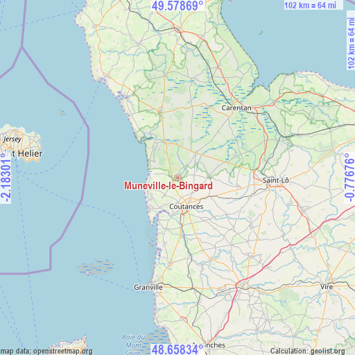
Muneville-le-Bingard GPS coordinates[2]
49° 7' 14.34" North, 1° 28' 47.568" West
| Map corner | latitude | longitude |
|---|---|---|
| Upper-left | 49.57869°, | -2.18301° |
| Center: | 49.12065°, | -1.47988° |
| Lower-right: | 48.65834°, | -0.77676° |
| Map W x H: | 102.3×102.3 km | = 63.6×63.6mi |
| max Lat: | 51.07786° ⇑17.4% North |
| Muneville-le-Bingard: | 49.12065° |
| min Lat: | ⇓82.6% South 41.3874° |
| min Long | Muneville-le-Bi | max Long |
| -5.08615° | -1.47988° | 9.52242° |
| W 7.9%⇐ | ⇒92.1% E |
Elevation
Elevation of Muneville-le-Bingard is 43 m = 141 ft, and this is 150.7 m = 494 ft below average elevation for this country.
| Max E: |
2333 m = 7654 ft | 84.5% |
| Avg. | 193.7 m = 635 ft | |
| Muneville-le-Bingard | 43 m = 141 ft | |
Min E: |
-1 m = -3 ft | 15.5% |
See also: France elevation on elevation.city.
Geographical zone
Muneville-le-Bingard is located in North temperate zone (between Tropic of Cancer and the Arctic Circle). Distance of this North polar circle is 1939.5 km =1205.1 mi to North.| Distance of | km | miles | from Muneville-le-Bingard |
|---|---|---|---|
| North Pole | 4545.4 | 2824.4 | to North |
| Arctic Circle | 1939.5 | 1205.1 | to North |
| Tropic Cancer | 2855.8 | 1774.5 | to South |
| Equator | 5461.7 | 3393.7 | to South |


Nearby cities:
15 places around Muneville-le-Bingard: (largest is in red/bold)
• Agon-Coutainville
11.2 km =7 mi,  218°
218°
• Blainville-sur-Mer
9.7 km =6 mi,  231°
231°
• Bricqueville-la-Blouette
9.6 km =6 mi,  179°
179°
• Cambernon
8.2 km =5.1 mi,  123°
123°
• Coutances
8.7 km =5.4 mi,  163°
163°
• Créances
10.9 km =6.8 mi,  323°
323°
• Gouville-sur-Mer
7.7 km =4.8 mi,  249°
249°
• Gratot
5.8 km =3.6 mi, 180°
• Heugueville-sur-Sienne
9.3 km =5.8 mi,  199°
199°
• Millières
7.5 km =4.7 mi,  10°
10°
• Monthuchon
6 km =3.7 mi,  137°
137°
• Pirou
9.6 km =6 mi,  314°
314°
• Périers
9 km =5.6 mi,  35°
35°
• Saint-Sauveur-Lendelin
4.9 km =3 mi,  77°
77°
• Tourville-sur-Sienne
9.7 km =6 mi,  210°
210°
Sources, notices
• [Note1] Compared only with cities in France existing in our database
• [Src1] Map data: © OpenStreetMap contributors (CC-BY-SA)
• [Src2] Other city data from geonames.org with taken over terms of usage.
• [Src3] Geographical zone / Annual Mean Temperature by Robert A. Rohde @ Wikipedia
