Coullons geodata
Coullons (Centre) is a populated place; located in France in Europe/Paris (GMT+2) time zone. With population of 2,423 people, there are 3993 cities with bigger population in this country. Compared to other cities in France, 53% of cities are located further ↓South; 50.5% of cities are located further ←West and 58.9% of cities have lower elevation than Coullons. Note1
Administrative division(s):
- Level 1: Centre
- Level 2: Loiret
- Level 3: Arrondissement de Montargis
- Level 4: Coullons


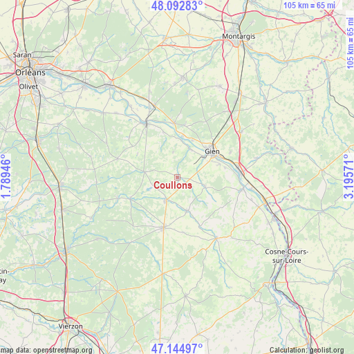
Coullons GPS coordinates[2]
47° 37' 15.78" North, 2° 29' 33.288" East
| Map corner | latitude | longitude |
|---|---|---|
| Upper-left | 48.09283°, | 1.78946° |
| Center: | 47.62105°, | 2.49258° |
| Lower-right: | 47.14497°, | 3.19571° |
| Map W x H: | 105.4×105.4 km | = 65.5×65.5mi |
| max Lat: | 51.07786° ⇑47% North |
| Coullons: | 47.62105° |
| min Lat: | ⇓53% South 41.3874° |
| min Long | Coullons | max Long |
| -5.08615° | 2.49258° | 9.52242° |
| W 50.5%⇐ | ⇒49.5% E |
Elevation
Elevation of Coullons is 165 m = 541 ft, and this is 28.7 m = 94 ft below average elevation for this country.
| Max E: |
2333 m = 7654 ft | 41.1% |
| Avg. | 193.7 m = 635 ft | |
| Coullons | 165 m = 541 ft | |
Min E: |
-1 m = -3 ft | 58.9% |
See also: France elevation on elevation.city.
Geographical zone
Coullons is located in North temperate zone (between Tropic of Cancer and the Arctic Circle). Distance of this North polar circle is 2106.2 km =1308.7 mi to North.| Distance of | km | miles | from Coullons |
|---|---|---|---|
| North Pole | 4712.1 | 2928 | to North |
| Arctic Circle | 2106.2 | 1308.7 | to North |
| Tropic Cancer | 2689 | 1670.9 | to South |
| Equator | 5295 | 3290.2 | to South |


Nearby cities:
15 places around Coullons: (largest is in red/bold)
• Argent-sur-Sauldre
7.9 km =4.9 mi,  207°
207°
• Aubigny-sur-Nère
15.3 km =9.5 mi,  195°
195°
• Autry-le-Châtel
8.6 km =5.3 mi,  106°
106°
• Blancafort
10.3 km =6.4 mi,  164°
164°
• Cerdon
9.9 km =6.2 mi,  279°
279°
• Clémont
15.2 km =9.4 mi,  247°
247°
• Dampierre-en-Burly
15.7 km =9.8 mi,  7°
7°
• Gien
13.1 km =8.1 mi,  52°
52°
• Nevoy
12.3 km =7.6 mi,  31°
31°
• Poilly-lez-Gien
10 km =6.2 mi, 51°
• Saint-Aignan-le-Jaillard
14.2 km =8.8 mi,  342°
342°
• Saint-Brisson-sur-Loire
14.5 km =9 mi,  78°
78°
• Saint-Gondon
9.3 km =5.8 mi,  23°
23°
• Saint-Martin-sur-Ocre
13.1 km =8.1 mi,  71°
71°
• Villemurlin
13.8 km =8.6 mi,  301°
301°
Sources, notices
• [Note1] Compared only with cities in France existing in our database
• [Src1] Map data: © OpenStreetMap contributors (CC-BY-SA)
• [Src2] Other city data from geonames.org with taken over terms of usage.
• [Src3] Geographical zone / Annual Mean Temperature by Robert A. Rohde @ Wikipedia
