Dampierre-en-Burly geodata
Dampierre-en-Burly (Centre) is a populated place; located in France in Europe/Paris (GMT+2) time zone. With population of 1,173 people, there are 7685 cities with bigger population in this country. Compared to other cities in France, 55.2% of cities are located further ↓South; 50.9% of cities are located further ←West and 54.2% of cities have lower elevation than Dampierre-en-Burly. Note1
Administrative division(s):
- Level 1: Centre
- Level 2: Loiret
- Level 3: Arrondissement d’Orléans
- Level 4: Dampierre-en-Burly


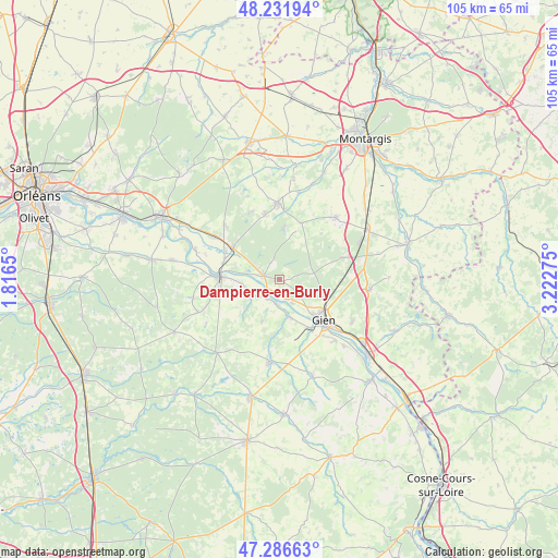
Dampierre-en-Burly GPS coordinates[2]
47° 45' 41.148" North, 2° 31' 10.632" East
| Map corner | latitude | longitude |
|---|---|---|
| Upper-left | 48.23194°, | 1.8165° |
| Center: | 47.76143°, | 2.51962° |
| Lower-right: | 47.28663°, | 3.22275° |
| Map W x H: | 105.1×105.1 km | = 65.3×65.3mi |
| max Lat: | 51.07786° ⇑44.8% North |
| Dampierre-en-Burly: | 47.76143° |
| min Lat: | ⇓55.2% South 41.3874° |
| min Long | Dampierre-en-Bu | max Long |
| -5.08615° | 2.51962° | 9.52242° |
| W 50.9%⇐ | ⇒49.1% E |
Elevation
Elevation of Dampierre-en-Burly is 147 m = 482 ft, and this is 46.7 m = 153 ft below average elevation for this country.
| Max E: |
2333 m = 7654 ft | 45.8% |
| Avg. | 193.7 m = 635 ft | |
| Dampierre-en-Burly | 147 m = 482 ft | |
Min E: |
-1 m = -3 ft | 54.2% |
See also: France elevation on elevation.city.
Geographical zone
Dampierre-en-Burly is located in North temperate zone (between Tropic of Cancer and the Arctic Circle). Distance of this North polar circle is 2090.6 km =1299 mi to North.| Distance of | km | miles | from Dampierre-en-Burly |
|---|---|---|---|
| North Pole | 4696.5 | 2918.3 | to North |
| Arctic Circle | 2090.6 | 1299 | to North |
| Tropic Cancer | 2704.7 | 1680.6 | to South |
| Equator | 5310.6 | 3299.9 | to South |


Nearby cities:
15 places around Dampierre-en-Burly: (largest is in red/bold)
• Boismorand
15.1 km =9.4 mi,  79°
79°
• Bonnée
10.9 km =6.8 mi,  290°
290°
• Bouzy-la-Forêt
14.6 km =9.1 mi,  313°
313°
• Bray-en-Val
13.7 km =8.5 mi,  303°
303°
• Gien
11.3 km =7 mi,  132°
132°
• Lorris
14.2 km =8.8 mi,  358°
358°
• Montereau
11.3 km =7 mi,  20°
20°
• Nevoy
6.7 km =4.2 mi,  139°
139°
• Ouzouer-sur-Loire
3 km =1.9 mi,  280°
280°
• Poilly-lez-Gien
11 km =6.8 mi,  148°
148°
• Saint-Aignan-le-Jaillard
6.5 km =4 mi,  251°
251°
• Saint-Gondon
7.3 km =4.5 mi,  166°
166°
• Saint-Martin-sur-Ocre
15.4 km =9.6 mi, 137°
• Saint-Père-sur-Loire
11.4 km =7.1 mi,  272°
272°
• Sully-sur-Loire
11 km =6.8 mi, 271°
Sources, notices
• [Note1] Compared only with cities in France existing in our database
• [Src1] Map data: © OpenStreetMap contributors (CC-BY-SA)
• [Src2] Other city data from geonames.org with taken over terms of usage.
• [Src3] Geographical zone / Annual Mean Temperature by Robert A. Rohde @ Wikipedia
