Coucouron geodata
Coucouron (Auvergne-Rhône-Alpes) is a populated place; located in France in Europe/Paris (GMT+2) time zone. With population of 747 people, there are 11194 cities with bigger population in this country. Compared to other cities in France, 81.4% of cities are located further ↑North; 67.5% of cities are located further ←West and 99.5% of cities have lower elevation than Coucouron. Note1
Administrative division(s):
- Level 1: Auvergne-Rhône-Alpes
- Level 2: Département de l'Ardèche
- Level 3: Arrondissement de Largentière
- Level 4: Coucouron


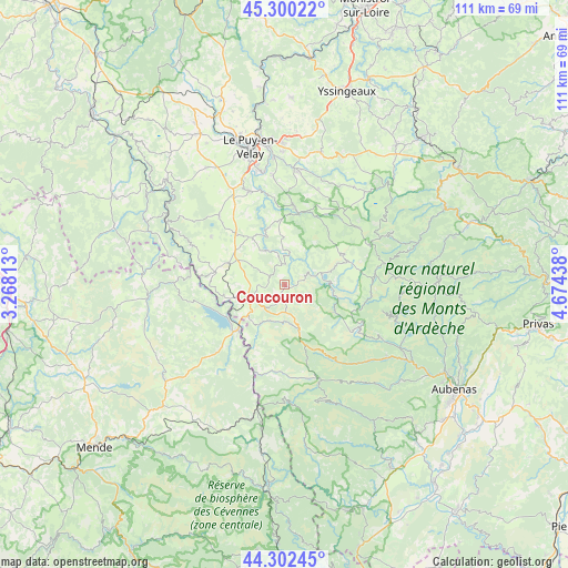
Coucouron GPS coordinates[2]
44° 48' 12.564" North, 3° 58' 16.5" East
| Map corner | latitude | longitude |
|---|---|---|
| Upper-left | 45.30022°, | 3.26813° |
| Center: | 44.80349°, | 3.97125° |
| Lower-right: | 44.30245°, | 4.67438° |
| Map W x H: | 110.9×110.9 km | = 68.9×68.9mi |
| max Lat: | 51.07786° ⇑81.4% North |
| Coucouron: | 44.80349° |
| min Lat: | ⇓18.6% South 41.3874° |
| min Long | Coucouron | max Long |
| -5.08615° | 3.97125° | 9.52242° |
| W 67.5%⇐ | ⇒32.5% E |
Elevation
Elevation of Coucouron is 1155 m = 3789 ft, and this is 961.3 m = 3154 ft above average elevation for this country.
| Max E: |
2333 m = 7654 ft | 0.5% |
| Coucouron | 1155 m 3789 ft | |
| Avg. | 193.7 m = 635 ft | |
Min E: |
-1 m = -3 ft | 99.5% |
See also: France elevation on elevation.city.
Geographical zone
Coucouron is located in North temperate zone (between Tropic of Cancer and the Arctic Circle). Distance of this Northern Tropic circle is 2375.8 km =1476.3 mi to South.| Distance of | km | miles | from Coucouron |
|---|---|---|---|
| North Pole | 5025.4 | 3122.6 | to North |
| Arctic Circle | 2419.5 | 1503.4 | to North |
| Tropic Cancer | 2375.8 | 1476.3 | to South |
| Equator | 4981.7 | 3095.5 | to South |


Nearby cities:
15 places around Coucouron: (largest is in red/bold)
• Arsac-en-Velay
20.9 km =13 mi,  353°
353°
• Burzet
22.7 km =14.1 mi,  108°
108°
• Cayres
18.7 km =11.6 mi,  316°
316°
• Costaros
14 km =8.7 mi, 316°
• Coubon
22 km =13.7 mi, 348°
• Cussac-sur-Loire
21.6 km =13.4 mi,  341°
341°
• Landos
11.8 km =7.3 mi,  291°
291°
• Langogne
12.5 km =7.8 mi,  227°
227°
• Lantriac
22.1 km =13.7 mi,  6°
6°
• Laussonne
19.6 km =12.2 mi,  18°
18°
• Le Brignon
16.3 km =10.1 mi,  333°
333°
• Le Monastier-sur-Gazeille
14.6 km =9.1 mi, 8°
• Montpezat-sous-Bauzon
21.2 km =13.2 mi,  118°
118°
• Pradelles
8 km =5 mi,  241°
241°
• Solignac-sur-Loire
19.5 km =12.1 mi, 339°
Sources, notices
• [Note1] Compared only with cities in France existing in our database
• [Src1] Map data: © OpenStreetMap contributors (CC-BY-SA)
• [Src2] Other city data from geonames.org with taken over terms of usage.
• [Src3] Geographical zone / Annual Mean Temperature by Robert A. Rohde @ Wikipedia
