Pradelles geodata
Pradelles (Auvergne-Rhône-Alpes) is a populated place; located in France in Europe/Paris (GMT+2) time zone. With population of 662 people, there are 12351 cities with bigger population in this country. Compared to other cities in France, 81.6% of cities are located further ↑North; 66.8% of cities are located further ←West and 99.6% of cities have lower elevation than Pradelles. Note1
Administrative division(s):
- Level 1: Auvergne-Rhône-Alpes
- Level 2: Haute-Loire
- Level 3: Arrondissement du Puy-en-Velay
- Level 4: Pradelles


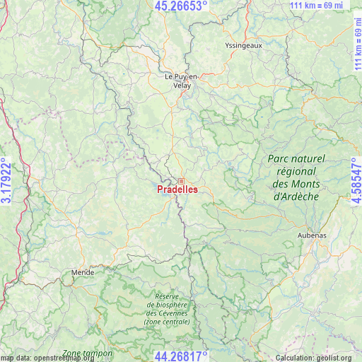
Pradelles GPS coordinates[2]
44° 46' 10.236" North, 3° 52' 56.424" East
| Map corner | latitude | longitude |
|---|---|---|
| Upper-left | 45.26653°, | 3.17922° |
| Center: | 44.76951°, | 3.88234° |
| Lower-right: | 44.26817°, | 4.58547° |
| Map W x H: | 111×111 km | = 69×69mi |
| max Lat: | 51.07786° ⇑81.6% North |
| Pradelles: | 44.76951° |
| min Lat: | ⇓18.4% South 41.3874° |
| min Long | Pradelles | max Long |
| -5.08615° | 3.88234° | 9.52242° |
| W 66.8%⇐ | ⇒33.2% E |
Elevation
Elevation of Pradelles is 1177 m = 3862 ft, and this is 983.3 m = 3226 ft above average elevation for this country.
| Max E: |
2333 m = 7654 ft | 0.40000000000001% |
| Pradelles | 1177 m 3862 ft | |
| Avg. | 193.7 m = 635 ft | |
Min E: |
-1 m = -3 ft | 99.6% |
See also: France elevation on elevation.city.
Geographical zone
Pradelles is located in North temperate zone (between Tropic of Cancer and the Arctic Circle). Distance of this Northern Tropic circle is 2372 km =1473.9 mi to South.| Distance of | km | miles | from Pradelles |
|---|---|---|---|
| North Pole | 5029.2 | 3125 | to North |
| Arctic Circle | 2423.3 | 1505.8 | to North |
| Tropic Cancer | 2372 | 1473.9 | to South |
| Equator | 4977.9 | 3093.1 | to South |


Nearby cities:
15 places around Pradelles: (largest is in red/bold)
• Arsac-en-Velay
25.1 km =15.6 mi,  11°
11°
• Cayres
18.3 km =11.4 mi,  341°
341°
• Châteauneuf-de-Randon
21.8 km =13.5 mi,  228°
228°
• Costaros
14.2 km =8.8 mi,  349°
349°
• Coubon
25.5 km =15.8 mi, 6°
• Coucouron
8 km =5 mi,  61°
61°
• Cussac-sur-Loire
24.3 km =15.1 mi,  0°
0°
• Grandrieu
19.6 km =12.2 mi,  274°
274°
• Landos
9.1 km =5.7 mi,  333°
333°
• Langogne
5.2 km =3.2 mi,  204°
204°
• Laussonne
26 km =16.2 mi,  30°
30°
• Le Brignon
18.4 km =11.4 mi,  359°
359°
• Le Monastier-sur-Gazeille
20.4 km =12.7 mi, 26°
• Saint-Christophe-sur-Dolaison
25.7 km =16 mi, 348°
• Solignac-sur-Loire
22.1 km =13.7 mi, 0°
Sources, notices
• [Note1] Compared only with cities in France existing in our database
• [Src1] Map data: © OpenStreetMap contributors (CC-BY-SA)
• [Src2] Other city data from geonames.org with taken over terms of usage.
• [Src3] Geographical zone / Annual Mean Temperature by Robert A. Rohde @ Wikipedia
