Colayrac-Saint-Cirq geodata
Colayrac-Saint-Cirq (Nouvelle-Aquitaine) is a populated place; located in France in Europe/Paris (GMT+2) time zone. With population of 2,880 people, there are 3389 cities with bigger population in this country. Compared to other cities in France, 85.4% of cities are located further ↑North; 72.9% of cities are located further →East and 85.3% of cities have higher elevation than Colayrac-Saint-Cirq. Note1
Administrative division(s):
- Level 1: Nouvelle-Aquitaine
- Level 2: Département du Lot-et-Garonne
- Level 3: Agen
- Level 4: Colayrac-Saint-Cirq


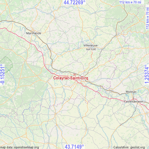
Colayrac-Saint-Cirq GPS coordinates[2]
44° 13' 15.42" North, 0° 33' 2.196" East
| Map corner | latitude | longitude |
|---|---|---|
| Upper-left | 44.72269°, | -0.15251° |
| Center: | 44.22095°, | 0.55061° |
| Lower-right: | 43.7149°, | 1.25374° |
| Map W x H: | 112.1×112.1 km | = 69.7×69.7mi |
| max Lat: | 51.07786° ⇑85.4% North |
| Colayrac-Saint-Cirq: | 44.22095° |
| min Lat: | ⇓14.6% South 41.3874° |
| min Long | Colayrac-Saint- | max Long |
| -5.08615° | 0.55061° | 9.52242° |
| W 27.1%⇐ | ⇒72.9% E |
Elevation
Elevation of Colayrac-Saint-Cirq is 41 m = 135 ft, and this is 152.7 m = 501 ft below average elevation for this country.
| Max E: |
2333 m = 7654 ft | 85.3% |
| Avg. | 193.7 m = 635 ft | |
| Colayrac-Saint-Cirq | 41 m = 135 ft | |
Min E: |
-1 m = -3 ft | 14.7% |
See also: France elevation on elevation.city.
Geographical zone
Colayrac-Saint-Cirq is located in North temperate zone (between Tropic of Cancer and the Arctic Circle). Distance of this Northern Tropic circle is 2311 km =1436 mi to South.| Distance of | km | miles | from Colayrac-Saint-Cirq |
|---|---|---|---|
| North Pole | 5090.2 | 3162.9 | to North |
| Arctic Circle | 2484.3 | 1543.7 | to North |
| Tropic Cancer | 2311 | 1436 | to South |
| Equator | 4916.9 | 3055.2 | to South |


Nearby cities:
15 places around Colayrac-Saint-Cirq: (largest is in red/bold)
• Agen
6.5 km =4 mi,  111°
111°
• Aubiac
8.9 km =5.5 mi,  174°
174°
• Bon-Encontre
10.1 km =6.3 mi, 113°
• Boé
9.2 km =5.7 mi,  137°
137°
• Brax
2 km =1.2 mi,  177°
177°
• Estillac
7.1 km =4.4 mi, 171°
• Foulayronnes
7.8 km =4.8 mi,  74°
74°
• Le Passage
4.7 km =2.9 mi,  117°
117°
• Montagnac-sur-Auvignon
9.8 km =6.1 mi,  227°
227°
• Montesquieu
9.2 km =5.7 mi,  256°
256°
• Pont-du-Casse
10.3 km =6.4 mi,  85°
85°
• Prayssas
8.6 km =5.3 mi,  312°
312°
• Roquefort
5.1 km =3.2 mi, 170°
• Sainte-Colombe-en-Bruilhois
5.5 km =3.4 mi,  210°
210°
• Sérignac-sur-Garonne
5.4 km =3.4 mi, 261°
Sources, notices
• [Note1] Compared only with cities in France existing in our database
• [Src1] Map data: © OpenStreetMap contributors (CC-BY-SA)
• [Src2] Other city data from geonames.org with taken over terms of usage.
• [Src3] Geographical zone / Annual Mean Temperature by Robert A. Rohde @ Wikipedia
