Cléguérec geodata
Cléguérec (Brittany) is a populated place; located in France in Europe/Paris (GMT+2) time zone. With population of 2,790 people, there are 3498 cities with bigger population in this country. Compared to other cities in France, 61.6% of cities are located further ↓South; 97.5% of cities are located further →East and 56.6% of cities have lower elevation than Cléguérec. Note1
Administrative division(s):
- Level 1: Brittany
- Level 2: Morbihan
- Level 3: Arrondissement de Pontivy
- Level 4: Cléguérec


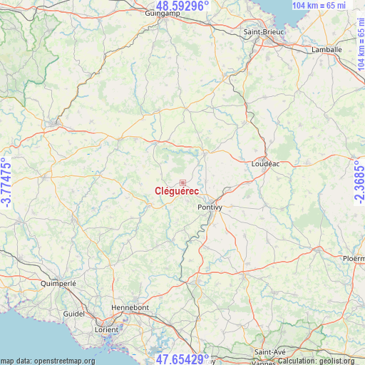
Cléguérec GPS coordinates[2]
48° 7' 32.772" North, 3° 4' 17.832" West
| Map corner | latitude | longitude |
|---|---|---|
| Upper-left | 48.59296°, | -3.77475° |
| Center: | 48.12577°, | -3.07162° |
| Lower-right: | 47.65429°, | -2.3685° |
| Map W x H: | 104.4×104.4 km | = 64.9×64.9mi |
| max Lat: | 51.07786° ⇑38.4% North |
| Cléguérec: | 48.12577° |
| min Lat: | ⇓61.6% South 41.3874° |
| min Long | Cléguérec | max Long |
| -5.08615° | -3.07162° | 9.52242° |
| W 2.5%⇐ | ⇒97.5% E |
Elevation
Elevation of Cléguérec is 156 m = 512 ft, and this is 37.7 m = 124 ft below average elevation for this country.
| Max E: |
2333 m = 7654 ft | 43.4% |
| Avg. | 193.7 m = 635 ft | |
| Cléguérec | 156 m = 512 ft | |
Min E: |
-1 m = -3 ft | 56.6% |
See also: France elevation on elevation.city.
Geographical zone
Cléguérec is located in North temperate zone (between Tropic of Cancer and the Arctic Circle). Distance of this North polar circle is 2050.1 km =1273.9 mi to North.| Distance of | km | miles | from Cléguérec |
|---|---|---|---|
| North Pole | 4656 | 2893.1 | to North |
| Arctic Circle | 2050.1 | 1273.9 | to North |
| Tropic Cancer | 2745.2 | 1705.8 | to South |
| Equator | 5351.1 | 3325 | to South |


Nearby cities:
15 places around Cléguérec: (largest is in red/bold)
• Gouarec
13.8 km =8.6 mi,  324°
324°
• Guern
10.8 km =6.7 mi,  187°
187°
• Guémené-sur-Scorff
11.6 km =7.2 mi,  235°
235°
• Kergrist
8.8 km =5.5 mi,  74°
74°
• Laniscat
13.5 km =8.4 mi,  343°
343°
• Le Sourn
11.1 km =6.9 mi,  146°
146°
• Malguénac
5.3 km =3.3 mi,  164°
164°
• Mûr-de-Bretagne
10.5 km =6.5 mi,  38°
38°
• Neulliac
6.6 km =4.1 mi,  87°
87°
• Plélauff
13.5 km =8.4 mi,  311°
311°
• Pontivy
10.3 km =6.4 mi,  128°
128°
• Saint-Aignan
7.5 km =4.7 mi,  34°
34°
• Saint-Gérand
13.5 km =8.4 mi,  98°
98°
• Saint-Thuriau
15.1 km =9.4 mi,  143°
143°
• Séglien
6.8 km =4.2 mi,  252°
252°
Sources, notices
• [Note1] Compared only with cities in France existing in our database
• [Src1] Map data: © OpenStreetMap contributors (CC-BY-SA)
• [Src2] Other city data from geonames.org with taken over terms of usage.
• [Src3] Geographical zone / Annual Mean Temperature by Robert A. Rohde @ Wikipedia
