Cirey-sur-Vezouze geodata
Cirey-sur-Vezouze (Grand Est) is a populated place; located in France in Europe/Paris (GMT+2) time zone. With population of 1,741 people, there are 5435 cities with bigger population in this country. Compared to other cities in France, 70.4% of cities are located further ↓South; 94.5% of cities are located further ←West and 81.8% of cities have lower elevation than Cirey-sur-Vezouze. Note1
Administrative division(s):
- Level 1: Grand Est
- Level 2: Meurthe-et-Moselle
- Level 3: Arrondissement de Lunéville
- Level 4: Cirey-sur-Vezouze


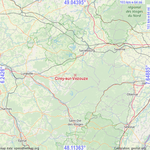
Cirey-sur-Vezouze GPS coordinates[2]
48° 34' 51.348" North, 6° 56' 44.628" East
| Map corner | latitude | longitude |
|---|---|---|
| Upper-left | 49.04395°, | 6.2426° |
| Center: | 48.58093°, | 6.94573° |
| Lower-right: | 48.11363°, | 7.64885° |
| Map W x H: | 103.4×103.4 km | = 64.2×64.2mi |
| max Lat: | 51.07786° ⇑29.6% North |
| Cirey-sur-Vezouze: | 48.58093° |
| min Lat: | ⇓70.4% South 41.3874° |
| min Long | Cirey-sur-Vezou | max Long |
| -5.08615° | 6.94573° | 9.52242° |
| W 94.5%⇐ | ⇒5.5% E |
Elevation
Elevation of Cirey-sur-Vezouze is 309 m = 1014 ft, and this is 115.3 m = 378 ft above average elevation for this country.
| Max E: |
2333 m = 7654 ft | 18.2% |
| Cirey-sur-Vezouze | 309 m 1014 ft | |
| Avg. | 193.7 m = 635 ft | |
Min E: |
-1 m = -3 ft | 81.8% |
See also: France elevation on elevation.city.
Geographical zone
Cirey-sur-Vezouze is located in North temperate zone (between Tropic of Cancer and the Arctic Circle). Distance of this North polar circle is 1999.5 km =1242.4 mi to North.| Distance of | km | miles | from Cirey-sur-Vezouze |
|---|---|---|---|
| North Pole | 4605.4 | 2861.7 | to North |
| Arctic Circle | 1999.5 | 1242.4 | to North |
| Tropic Cancer | 2795.8 | 1737.2 | to South |
| Equator | 5401.7 | 3356.5 | to South |


Nearby cities:
15 places around Cirey-sur-Vezouze: (largest is in red/bold)
• Abreschviller
12.7 km =7.9 mi,  60°
60°
• Avricourt
13.2 km =8.2 mi,  305°
305°
• Badonviller
9.7 km =6 mi,  203°
203°
• Brouderdorff
17.3 km =10.7 mi,  41°
41°
• Celles-sur-Plaine
14.1 km =8.8 mi,  178°
178°
• Hartzviller
14.2 km =8.8 mi,  46°
46°
• Hesse
14.6 km =9.1 mi,  31°
31°
• Imling
16.4 km =10.2 mi,  20°
20°
• Lorquin
10.8 km =6.7 mi, 21°
• Moussey
15.8 km =9.8 mi, 310°
• Nitting
11.7 km =7.3 mi, 31°
• Plaine-de-Walsch
17.5 km =10.9 mi, 45°
• Réchicourt-le-Château
12.2 km =7.6 mi,  320°
320°
• Saint-Quirin
9.4 km =5.8 mi,  69°
69°
• Walscheid
17 km =10.6 mi, 61°
Sources, notices
• [Note1] Compared only with cities in France existing in our database
• [Src1] Map data: © OpenStreetMap contributors (CC-BY-SA)
• [Src2] Other city data from geonames.org with taken over terms of usage.
• [Src3] Geographical zone / Annual Mean Temperature by Robert A. Rohde @ Wikipedia
