Avricourt geodata
Avricourt (Grand Est) is a populated place; located in France in Europe/Paris (GMT+2) time zone. With population of 669 people, there are 12229 cities with bigger population in this country. Compared to other cities in France, 72.1% of cities are located further ↓South; 93.6% of cities are located further ←West and 78% of cities have lower elevation than Avricourt. Note1
Administrative division(s):
- Level 1: Grand Est
- Level 2: Moselle
- Level 3: Arrondissement de Sarrebourg-Château-Salins
- Level 4: Avricourt


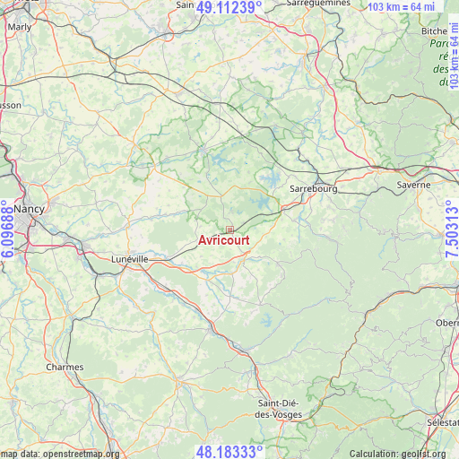
Avricourt GPS coordinates[2]
48° 39' 0" North, 6° 48' 0" East
| Map corner | latitude | longitude |
|---|---|---|
| Upper-left | 49.11239°, | 6.09688° |
| Center: | 48.65°, | 6.8° |
| Lower-right: | 48.18333°, | 7.50313° |
| Map W x H: | 103.3×103.3 km | = 64.2×64.2mi |
| max Lat: | 51.07786° ⇑27.9% North |
| Avricourt: | 48.65° |
| min Lat: | ⇓72.1% South 41.3874° |
| min Long | Avricourt | max Long |
| -5.08615° | 6.8° | 9.52242° |
| W 93.6%⇐ | ⇒6.4% E |
Elevation
Elevation of Avricourt is 272 m = 892 ft, and this is 78.3 m = 257 ft above average elevation for this country.
| Max E: |
2333 m = 7654 ft | 22% |
| Avricourt | 272 m 892 ft | |
| Avg. | 193.7 m = 635 ft | |
Min E: |
-1 m = -3 ft | 78% |
See also: France elevation on elevation.city.
Geographical zone
Avricourt is located in North temperate zone (between Tropic of Cancer and the Arctic Circle). Distance of this North polar circle is 1991.8 km =1237.6 mi to North.| Distance of | km | miles | from Avricourt |
|---|---|---|---|
| North Pole | 4597.7 | 2856.9 | to North |
| Arctic Circle | 1991.8 | 1237.6 | to North |
| Tropic Cancer | 2803.5 | 1742 | to South |
| Equator | 5409.4 | 3361.2 | to South |


Nearby cities:
15 places around Avricourt: (largest is in red/bold)
• Azerailles
19.5 km =12.1 mi,  203°
203°
• Badonviller
17.9 km =11.1 mi,  157°
157°
• Bénaménil
13 km =8.1 mi,  227°
227°
• Chenevières
19.2 km =11.9 mi,  220°
220°
• Cirey-sur-Vezouze
13.2 km =8.2 mi,  125°
125°
• Croismare
17.8 km =11.1 mi,  251°
251°
• Dieuze
19.1 km =11.9 mi,  341°
341°
• Hesse
18.9 km =11.7 mi,  75°
75°
• Imling
18.1 km =11.2 mi,  64°
64°
• Lorquin
14.8 km =9.2 mi, 80°
• Marainviller
16.2 km =10.1 mi, 245°
• Moussey
2.9 km =1.8 mi,  333°
333°
• Nitting
17 km =10.6 mi, 82°
• Réchicourt-le-Château
3.3 km =2.1 mi, 59°
• Saint-Clément
19.6 km =12.2 mi, 227°
Sources, notices
• [Note1] Compared only with cities in France existing in our database
• [Src1] Map data: © OpenStreetMap contributors (CC-BY-SA)
• [Src2] Other city data from geonames.org with taken over terms of usage.
• [Src3] Geographical zone / Annual Mean Temperature by Robert A. Rohde @ Wikipedia
