Chevrières geodata
Chevrières (Hauts-de-France) is a populated place; located in France in Europe/Paris (GMT+2) time zone. With population of 1,763 people, there are 5369 cities with bigger population in this country. Compared to other cities in France, 86.9% of cities are located further ↓South; 53.2% of cities are located further ←West and 86.2% of cities have higher elevation than Chevrières. Note1
Administrative division(s):
- Level 1: Hauts-de-France
- Level 2: Département de l'Oise
- Level 3: Arrondissement de Compiègne
- Level 4: Chevrières


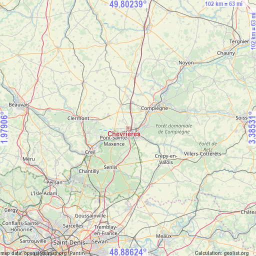
Chevrières GPS coordinates[2]
49° 20' 47.22" North, 2° 40' 55.884" East
| Map corner | latitude | longitude |
|---|---|---|
| Upper-left | 49.80239°, | 1.97906° |
| Center: | 49.34645°, | 2.68219° |
| Lower-right: | 48.88624°, | 3.38531° |
| Map W x H: | 101.9×101.9 km | = 63.3×63.3mi |
| max Lat: | 51.07786° ⇑13.1% North |
| Chevrières: | 49.34645° |
| min Lat: | ⇓86.9% South 41.3874° |
| min Long | Chevrières | max Long |
| -5.08615° | 2.68219° | 9.52242° |
| W 53.2%⇐ | ⇒46.8% E |
Elevation
Elevation of Chevrières is 39 m = 128 ft, and this is 154.7 m = 508 ft below average elevation for this country.
| Max E: |
2333 m = 7654 ft | 86.2% |
| Avg. | 193.7 m = 635 ft | |
| Chevrières | 39 m = 128 ft | |
Min E: |
-1 m = -3 ft | 13.8% |
See also: France elevation on elevation.city.
Geographical zone
Chevrières is located in North temperate zone (between Tropic of Cancer and the Arctic Circle). Distance of this North polar circle is 1914.4 km =1189.6 mi to North.| Distance of | km | miles | from Chevrières |
|---|---|---|---|
| North Pole | 4520.3 | 2808.8 | to North |
| Arctic Circle | 1914.4 | 1189.6 | to North |
| Tropic Cancer | 2880.9 | 1790.1 | to South |
| Equator | 5486.8 | 3409.3 | to South |


Nearby cities:
15 places around Chevrières: (largest is in red/bold)
• Armancourt
6.7 km =4.2 mi,  64°
64°
• Arsy
6.1 km =3.8 mi,  5°
5°
• Canly
4.8 km =3 mi,  23°
23°
• Grandfresnoy
3.6 km =2.2 mi,  322°
322°
• Houdancourt
3 km =1.9 mi,  265°
265°
• Jonquières
6 km =3.7 mi,  37°
37°
• Le Meux
5 km =3.1 mi, 62°
• Longueil-Sainte-Marie
2.9 km =1.8 mi,  65°
65°
• Pontpoint
5.7 km =3.5 mi,  204°
204°
• Rivecourt
3.8 km =2.4 mi,  87°
87°
• Sacy-le-Petit
4.1 km =2.5 mi,  292°
292°
• Saint-Martin-Longueau
5.8 km =3.6 mi, 265°
• Saint-Pierre
5.4 km =3.4 mi, 200°
• Saint-Vaast-de-Longmont
6.2 km =3.9 mi,  140°
140°
• Verberie
5.3 km =3.3 mi, 137°
Sources, notices
• [Note1] Compared only with cities in France existing in our database
• [Src1] Map data: © OpenStreetMap contributors (CC-BY-SA)
• [Src2] Other city data from geonames.org with taken over terms of usage.
• [Src3] Geographical zone / Annual Mean Temperature by Robert A. Rohde @ Wikipedia
