Saint-Martin-Longueau geodata
Saint-Martin-Longueau (Hauts-de-France) is a populated place; located in France in Europe/Paris (GMT+2) time zone. With population of 1,476 people, there are 6269 cities with bigger population in this country. Compared to other cities in France, 86.9% of cities are located further ↓South; 52.1% of cities are located further ←West and 87.8% of cities have higher elevation than Saint-Martin-Longueau. Note1
Administrative division(s):
- Level 1: Hauts-de-France
- Level 2: Département de l'Oise
- Level 3: Arrondissement de Clermont
- Level 4: Saint-Martin-Longueau
Current local time in Saint-Martin-Longueau:
06:03 AM, SaturdayDifference from your time zone: hours


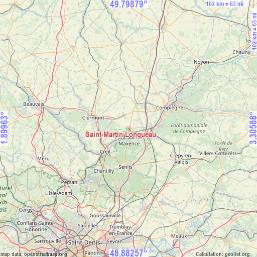
Saint-Martin-Longueau GPS coordinates[2]
49° 20' 34.116" North, 2° 36' 9.936" East
| Map corner | latitude | longitude |
|---|---|---|
| Upper-left | 49.79879°, | 1.89963° |
| Center: | 49.34281°, | 2.60276° |
| Lower-right: | 48.88257°, | 3.30588° |
| Map W x H: | 101.9×101.9 km | = 63.3×63.3mi |
| max Lat: | 51.07786° ⇑13.1% North |
| Saint-Martin-Longueau: | 49.34281° |
| min Lat: | ⇓86.9% South 41.3874° |
| min Long | Saint-Martin-Lo | max Long |
| -5.08615° | 2.60276° | 9.52242° |
| W 52.1%⇐ | ⇒47.9% E |
Elevation
Elevation of Saint-Martin-Longueau is 35 m = 115 ft, and this is 158.7 m = 521 ft below average elevation for this country.
| Max E: |
2333 m = 7654 ft | 87.8% |
| Avg. | 193.7 m = 635 ft | |
| Saint-Martin-Longueau | 35 m = 115 ft | |
Min E: |
-1 m = -3 ft | 12.2% |
See also: France elevation on elevation.city.
Geographical zone
Saint-Martin-Longueau is located in North temperate zone (between Tropic of Cancer and the Arctic Circle). Distance of this North polar circle is 1914.8 km =1189.8 mi to North.| Distance of | km | miles | from Saint-Martin-Longueau |
|---|---|---|---|
| North Pole | 4520.7 | 2809 | to North |
| Arctic Circle | 1914.8 | 1189.8 | to North |
| Tropic Cancer | 2880.5 | 1789.9 | to South |
| Equator | 5486.4 | 3409.1 | to South |


Nearby cities:
15 places around Saint-Martin-Longueau: (largest is in red/bold)
• Brenouille
5.9 km =3.7 mi,  225°
225°
• Catenoy
7.3 km =4.5 mi,  292°
292°
• Chevrières
5.8 km =3.6 mi,  85°
85°
• Cinqueux
6 km =3.7 mi,  241°
241°
• Grandfresnoy
4.8 km =3 mi,  47°
47°
• Houdancourt
2.7 km =1.7 mi, 86°
• Labruyère
6.8 km =4.2 mi,  277°
277°
• Les Ageux
2.9 km =1.8 mi,  183°
183°
• Monceaux
4.6 km =2.9 mi, 234°
• Pont-Sainte-Maxence
4.6 km =2.9 mi, 178°
• Pontpoint
5.9 km =3.7 mi,  144°
144°
• Rosoy
7.4 km =4.6 mi,  267°
267°
• Sacy-le-Grand
4.4 km =2.7 mi, 287°
• Sacy-le-Petit
2.8 km =1.7 mi,  43°
43°
• Saint-Pierre
6.1 km =3.8 mi, 140°
Sources, notices
• [Note1] Compared only with cities in France existing in our database
• [Src1] Map data: © OpenStreetMap contributors (CC-BY-SA)
• [Src2] Other city data from geonames.org with taken over terms of usage.
• [Src3] Geographical zone / Annual Mean Temperature by Robert A. Rohde @ Wikipedia
