Chaveyriat geodata
Chaveyriat (Auvergne-Rhône-Alpes) is a populated place; located in France in Europe/Paris (GMT+2) time zone. With population of 891 people, there are 9734 cities with bigger population in this country. Compared to other cities in France, 63.6% of cities are located further ↑North; 78.3% of cities are located further ←West and 74.9% of cities have lower elevation than Chaveyriat. Note1
Administrative division(s):
- Level 1: Auvergne-Rhône-Alpes
- Level 2: Département de l'Ain
- Level 3: Arrondissement de Bourg-en-Bresse
- Level 4: Chaveyriat


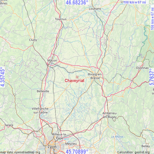
Chaveyriat GPS coordinates[2]
46° 11' 52.188" North, 5° 3' 38.052" East
| Map corner | latitude | longitude |
|---|---|---|
| Upper-left | 46.68236°, | 4.35745° |
| Center: | 46.19783°, | 5.06057° |
| Lower-right: | 45.70899°, | 5.7637° |
| Map W x H: | 108.2×108.2 km | = 67.2×67.2mi |
| max Lat: | 51.07786° ⇑63.6% North |
| Chaveyriat: | 46.19783° |
| min Lat: | ⇓36.4% South 41.3874° |
| min Long | Chaveyriat | max Long |
| -5.08615° | 5.06057° | 9.52242° |
| W 78.3%⇐ | ⇒21.7% E |
Elevation
Elevation of Chaveyriat is 248 m = 814 ft, and this is 54.3 m = 178 ft above average elevation for this country.
| Max E: |
2333 m = 7654 ft | 25.1% |
| Chaveyriat | 248 m 814 ft | |
| Avg. | 193.7 m = 635 ft | |
Min E: |
-1 m = -3 ft | 74.9% |
See also: France elevation on elevation.city.
Geographical zone
Chaveyriat is located in North temperate zone (between Tropic of Cancer and the Arctic Circle). Distance of this North polar circle is 2264.5 km =1407.1 mi to North.| Distance of | km | miles | from Chaveyriat |
|---|---|---|---|
| North Pole | 4870.3 | 3026.3 | to North |
| Arctic Circle | 2264.5 | 1407.1 | to North |
| Tropic Cancer | 2530.8 | 1572.6 | to South |
| Equator | 5136.7 | 3191.8 | to South |


Nearby cities:
15 places around Chaveyriat: (largest is in red/bold)
• Buellas
5.7 km =3.5 mi,  75°
75°
• Chanoz-Châtenay
2.6 km =1.6 mi,  237°
237°
• Condeissiat
4.8 km =3 mi,  162°
162°
• Confrançon
7.6 km =4.7 mi,  3°
3°
• Montcet
4.3 km =2.7 mi,  68°
68°
• Montracol
4.6 km =2.9 mi,  92°
92°
• Mézériat
4.5 km =2.8 mi,  345°
345°
• Neuville-les-Dames
5.7 km =3.5 mi,  226°
226°
• Polliat
7.6 km =4.7 mi,  42°
42°
• Saint-André-sur-Vieux-Jonc
8 km =5 mi,  123°
123°
• Saint-Julien-sur-Veyle
8 km =5 mi,  272°
272°
• Saint-Rémy
8.1 km =5 mi,  96°
96°
• Sulignat
8.2 km =5.1 mi,  250°
250°
• Vandeins
2.5 km =1.6 mi,  34°
34°
• Vonnas
5.7 km =3.5 mi,  292°
292°
Sources, notices
• [Note1] Compared only with cities in France existing in our database
• [Src1] Map data: © OpenStreetMap contributors (CC-BY-SA)
• [Src2] Other city data from geonames.org with taken over terms of usage.
• [Src3] Geographical zone / Annual Mean Temperature by Robert A. Rohde @ Wikipedia
