Châtel-de-Neuvre geodata
Châtel-de-Neuvre (Auvergne-Rhône-Alpes) is a populated place; located in France in Europe/Paris (GMT+2) time zone. With population of 518 people, there are 14866 cities with bigger population in this country. Compared to other cities in France, 61% of cities are located further ↑North; 62.2% of cities are located further ←West and 74.9% of cities have lower elevation than Châtel-de-Neuvre. Note1
Administrative division(s):
- Level 1: Auvergne-Rhône-Alpes
- Level 2: Département de l'Allier
- Level 3: Arrondissement de Moulins
- Level 4: Châtel-de-Neuvre


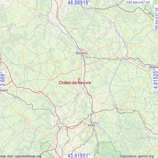
Châtel-de-Neuvre GPS coordinates[2]
46° 24' 23.4" North, 3° 18' 43.632" East
| Map corner | latitude | longitude |
|---|---|---|
| Upper-left | 46.88918°, | 2.609° |
| Center: | 46.4065°, | 3.31212° |
| Lower-right: | 45.91951°, | 4.01525° |
| Map W x H: | 107.8×107.8 km | = 67×67mi |
| max Lat: | 51.07786° ⇑61% North |
| Châtel-de-Neuvre: | 46.4065° |
| min Lat: | ⇓39% South 41.3874° |
| min Long | Châtel-de-Neuv | max Long |
| -5.08615° | 3.31212° | 9.52242° |
| W 62.2%⇐ | ⇒37.8% E |
Elevation
Elevation of Châtel-de-Neuvre is 248 m = 814 ft, and this is 54.3 m = 178 ft above average elevation for this country.
| Max E: |
2333 m = 7654 ft | 25.1% |
| Châtel-de-Neuvre | 248 m 814 ft | |
| Avg. | 193.7 m = 635 ft | |
Min E: |
-1 m = -3 ft | 74.9% |
See also: France elevation on elevation.city.
Geographical zone
Châtel-de-Neuvre is located in North temperate zone (between Tropic of Cancer and the Arctic Circle). Distance of this North polar circle is 2241.3 km =1392.7 mi to North.| Distance of | km | miles | from Châtel-de-Neuvre |
|---|---|---|---|
| North Pole | 4847.1 | 3011.8 | to North |
| Arctic Circle | 2241.3 | 1392.7 | to North |
| Tropic Cancer | 2554 | 1587 | to South |
| Equator | 5159.9 | 3206.2 | to South |


Nearby cities:
15 places around Châtel-de-Neuvre: (largest is in red/bold)
• Bessay-sur-Allier
5.5 km =3.4 mi,  44°
44°
• Besson
8 km =5 mi,  332°
332°
• Bransat
11.3 km =7 mi,  214°
214°
• Bressolles
13.8 km =8.6 mi,  1°
1°
• Chemilly
9.1 km =5.7 mi, 1°
• Contigny
6 km =3.7 mi,  185°
185°
• Cressanges
12.4 km =7.7 mi,  290°
290°
• Montoldre
13.1 km =8.1 mi,  127°
127°
• Neuilly-le-Réal
11.2 km =7 mi,  55°
55°
• Paray-sous-Briailles
13.5 km =8.4 mi,  162°
162°
• Saint-Loup
8 km =5 mi,  140°
140°
• Saint-Pourçain-sur-Sioule
11.1 km =6.9 mi, 189°
• Saulcet
9.8 km =6.1 mi,  202°
202°
• Toulon-sur-Allier
13 km =8.1 mi,  16°
16°
• Varennes-sur-Allier
12.4 km =7.7 mi,  146°
146°
Sources, notices
• [Note1] Compared only with cities in France existing in our database
• [Src1] Map data: © OpenStreetMap contributors (CC-BY-SA)
• [Src2] Other city data from geonames.org with taken over terms of usage.
• [Src3] Geographical zone / Annual Mean Temperature by Robert A. Rohde @ Wikipedia
