Châteaulin geodata
Châteaulin (Brittany) is a seat of a third-order administrative division; located in France in Europe/Paris (GMT+2) time zone. With population of 5,379 people, there are 1832 cities with bigger population in this country. Compared to other cities in France, 62.8% of cities are located further ↓South; 99.1% of cities are located further →East and 89.9% of cities have higher elevation than Châteaulin. Note1
Administrative division(s):
- Level 1: Brittany
- Level 2: Département du Finistère
- Level 3: Arrondissement de Châteaulin
- Level 4: Châteaulin


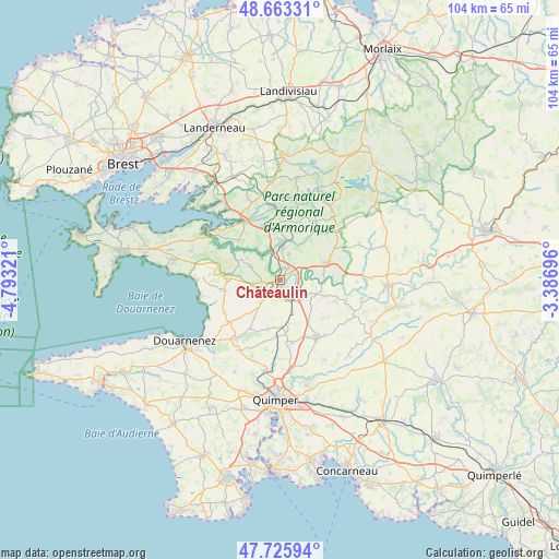
Châteaulin GPS coordinates[2]
48° 11' 48.372" North, 4° 5' 24.288" West
| Map corner | latitude | longitude |
|---|---|---|
| Upper-left | 48.66331°, | -4.79321° |
| Center: | 48.19677°, | -4.09008° |
| Lower-right: | 47.72594°, | -3.38696° |
| Map W x H: | 104.2×104.2 km | = 64.7×64.7mi |
| max Lat: | 51.07786° ⇑37.2% North |
| Châteaulin: | 48.19677° |
| min Lat: | ⇓62.8% South 41.3874° |
| min Long | Châteaulin | max Long |
| -5.08615° | -4.09008° | 9.52242° |
| W 0.9%⇐ | ⇒99.1% E |
Elevation
Elevation of Châteaulin is 30 m = 98 ft, and this is 163.7 m = 537 ft below average elevation for this country.
| Max E: |
2333 m = 7654 ft | 89.9% |
| Avg. | 193.7 m = 635 ft | |
| Châteaulin | 30 m = 98 ft | |
Min E: |
-1 m = -3 ft | 10.1% |
See also: France elevation on elevation.city.
Geographical zone
Châteaulin is located in North temperate zone (between Tropic of Cancer and the Arctic Circle). Distance of this North polar circle is 2042.2 km =1269 mi to North.| Distance of | km | miles | from Châteaulin |
|---|---|---|---|
| North Pole | 4648.1 | 2888.2 | to North |
| Arctic Circle | 2042.2 | 1269 | to North |
| Tropic Cancer | 2753.1 | 1710.7 | to South |
| Equator | 5359 | 3329.9 | to South |


Nearby cities:
15 places around Châteaulin: (largest is in red/bold)
• Briec
12.6 km =7.8 mi,  147°
147°
• Cast
5.7 km =3.5 mi,  219°
219°
• Dinéault
6 km =3.7 mi,  294°
294°
• Edern
13.4 km =8.3 mi,  143°
143°
• Gouézec
9.2 km =5.7 mi,  109°
109°
• Landrévarzec
11.9 km =7.4 mi,  169°
169°
• Le Faou
12.7 km =7.9 mi,  328°
328°
• Lennon
14.3 km =8.9 mi,  91°
91°
• Locronan
14 km =8.7 mi, 218°
• Lopérec
9.5 km =5.9 mi,  19°
19°
• Pleyben
10 km =6.2 mi,  66°
66°
• Plomodiern
10.7 km =6.6 mi,  261°
261°
• Quéménéven
9.1 km =5.7 mi,  192°
192°
• Rosnoën
11.3 km =7 mi,  313°
313°
• Saint-Ségal
4.4 km =2.7 mi, 23°
Sources, notices
• [Note1] Compared only with cities in France existing in our database
• [Src1] Map data: © OpenStreetMap contributors (CC-BY-SA)
• [Src2] Other city data from geonames.org with taken over terms of usage.
• [Src3] Geographical zone / Annual Mean Temperature by Robert A. Rohde @ Wikipedia
