Pleyben geodata
Pleyben (Brittany) is a populated place; located in France in Europe/Paris (GMT+1) time zone. With population of 3,938 people, there are 2501 cities with bigger population in this country. Compared to other cities in France, 63.3% of cities are located further ↓South; 98.9% of cities are located further →East and 63.2% of cities have higher elevation than Pleyben. Note1
Administrative division(s):
- Level 1: Brittany
- Level 2: Département du Finistère
- Level 3: Arrondissement de Châteaulin
- Level 4: Pleyben


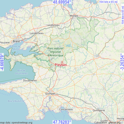
Pleyben GPS coordinates[2]
48° 13' 59.988" North, 3° 58' 0.012" West
| Map corner | latitude | longitude |
|---|---|---|
| Upper-left | 48.69954°, | -4.66979° |
| Center: | 48.23333°, | -3.96667° |
| Lower-right: | 47.76283°, | -3.26354° |
| Map W x H: | 104.2×104.1 km | = 64.7×64.7mi |
| max Lat: | 51.07786° ⇑36.7% North |
| Pleyben: | 48.23333° |
| min Lat: | ⇓63.3% South 41.3874° |
| min Long | Pleyben | max Long |
| -5.08615° | -3.96667° | 9.52242° |
| W 1.1%⇐ | ⇒98.9% E |
Elevation
Elevation of Pleyben is 94 m = 308 ft, and this is 99.7 m = 327 ft below average elevation for this country.
| Max E: |
2333 m = 7654 ft | 63.2% |
| Avg. | 193.7 m = 635 ft | |
| Pleyben | 94 m = 308 ft | |
Min E: |
-1 m = -3 ft | 36.8% |
See also: France elevation on elevation.city.
Geographical zone
Pleyben is located in North temperate zone (between Tropic of Cancer and the Arctic Circle). Distance of this North polar circle is 2038.1 km =1266.4 mi to North.| Distance of | km | miles | from Pleyben |
|---|---|---|---|
| North Pole | 4644 | 2885.6 | to North |
| Arctic Circle | 2038.1 | 1266.4 | to North |
| Tropic Cancer | 2757.1 | 1713.2 | to South |
| Equator | 5363 | 3332.4 | to South |


Nearby cities:
15 places around Pleyben: (largest is in red/bold)
• Brasparts
7.6 km =4.7 mi,  6°
6°
• Briec
14.8 km =9.2 mi,  189°
189°
• Cast
15.3 km =9.5 mi,  236°
236°
• Châteaulin
10 km =6.2 mi,  246°
246°
• Châteauneuf-du-Faou
12.1 km =7.5 mi,  114°
114°
• Dinéault
14.7 km =9.1 mi,  263°
263°
• Edern
14.9 km =9.3 mi,  184°
184°
• Gouézec
7.2 km =4.5 mi, 183°
• Laz
14.4 km =8.9 mi,  137°
137°
• Le Cloître-Pleyben
6.3 km =3.9 mi,  64°
64°
• Lennon
6.9 km =4.3 mi,  131°
131°
• Lopérec
7.7 km =4.8 mi,  309°
309°
• Plonévez-du-Faou
10 km =6.2 mi,  79°
79°
• Saint-Ségal
7.4 km =4.6 mi,  270°
270°
• Saint-Thois
9.6 km =6 mi, 140°
Sources, notices
• [Note1] Compared only with cities in France existing in our database
• [Src1] Map data: © OpenStreetMap contributors (CC-BY-SA)
• [Src2] Other city data from geonames.org with taken over terms of usage.
• [Src3] Geographical zone / Annual Mean Temperature by Robert A. Rohde @ Wikipedia
