Champigny-le-Sec geodata
Champigny-le-Sec (Nouvelle-Aquitaine) is a populated place; located in France in Europe/Paris (GMT+2) time zone. With population of 848 people, there are 10102 cities with bigger population in this country. Compared to other cities in France, 58.1% of cities are located further ↑North; 76.7% of cities are located further →East and 56.2% of cities have higher elevation than Champigny-le-Sec. Note1
Administrative division(s):
- Level 1: Nouvelle-Aquitaine
- Level 2: Vienne
- Level 3: Arrondissement de Poitiers
- Level 4: Champigny en Rochereau


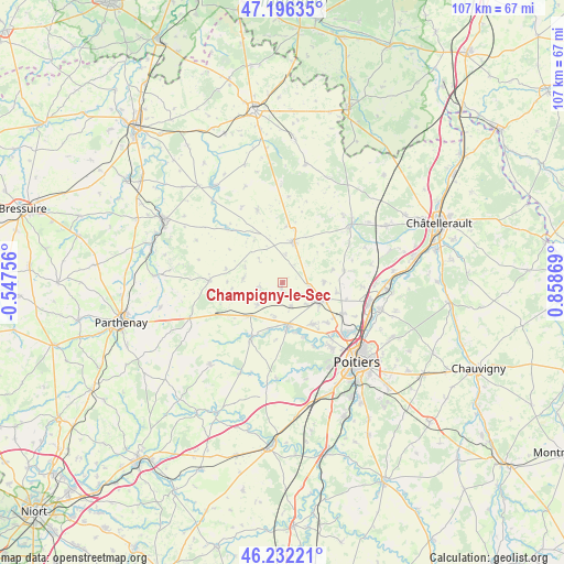
Champigny-le-Sec GPS coordinates[2]
46° 42' 59.148" North, 0° 9' 20.016" East
| Map corner | latitude | longitude |
|---|---|---|
| Upper-left | 47.19635°, | -0.54756° |
| Center: | 46.71643°, | 0.15556° |
| Lower-right: | 46.23221°, | 0.85869° |
| Map W x H: | 107.2×107.2 km | = 66.6×66.6mi |
| max Lat: | 51.07786° ⇑58.1% North |
| Champigny-le-Sec: | 46.71643° |
| min Lat: | ⇓41.9% South 41.3874° |
| min Long | Champigny-le-Se | max Long |
| -5.08615° | 0.15556° | 9.52242° |
| W 23.3%⇐ | ⇒76.7% E |
Elevation
Elevation of Champigny-le-Sec is 113 m = 371 ft, and this is 80.7 m = 265 ft below average elevation for this country.
| Max E: |
2333 m = 7654 ft | 56.2% |
| Avg. | 193.7 m = 635 ft | |
| Champigny-le-Sec | 113 m = 371 ft | |
Min E: |
-1 m = -3 ft | 43.8% |
See also: France elevation on elevation.city.
Geographical zone
Champigny-le-Sec is located in North temperate zone (between Tropic of Cancer and the Arctic Circle). Distance of this North polar circle is 2206.8 km =1371.2 mi to North.| Distance of | km | miles | from Champigny-le-Sec |
|---|---|---|---|
| North Pole | 4812.7 | 2990.5 | to North |
| Arctic Circle | 2206.8 | 1371.2 | to North |
| Tropic Cancer | 2588.5 | 1608.4 | to South |
| Equator | 5194.4 | 3227.6 | to South |


Nearby cities:
15 places around Champigny-le-Sec: (largest is in red/bold)
• Avanton
12.7 km =7.9 mi,  117°
117°
• Ayron
8.8 km =5.5 mi,  224°
224°
• Chabournay
7.8 km =4.8 mi,  89°
89°
• Charrais
4 km =2.5 mi, 120°
• Cherves
10.5 km =6.5 mi,  271°
271°
• Chiré-en-Montreuil
8.9 km =5.5 mi,  194°
194°
• Chouppes
10.6 km =6.6 mi,  3°
3°
• Cissé
9.6 km =6 mi,  144°
144°
• Latillé
12.4 km =7.7 mi,  209°
209°
• Le Rochereau
1 km =0.6 mi, 188°
• Mirebeau
7.9 km =4.9 mi,  14°
14°
• Neuville-de-Poitou
7.6 km =4.7 mi, 117°
• Thurageau
8.8 km =5.5 mi,  48°
48°
• Vendeuvre-du-Poitou
11.9 km =7.4 mi,  79°
79°
• Vouillé
8.4 km =5.2 mi,  173°
173°
Sources, notices
• [Note1] Compared only with cities in France existing in our database
• [Src1] Map data: © OpenStreetMap contributors (CC-BY-SA)
• [Src2] Other city data from geonames.org with taken over terms of usage.
• [Src3] Geographical zone / Annual Mean Temperature by Robert A. Rohde @ Wikipedia
