Mirebeau geodata
Mirebeau (Nouvelle-Aquitaine) is a populated place; located in France in Europe/Paris (GMT+2) time zone. With population of 2,408 people, there are 4016 cities with bigger population in this country. Compared to other cities in France, 57.3% of cities are located further ↑North; 76.5% of cities are located further →East and 55% of cities have lower elevation than Mirebeau. Note1
Administrative division(s):
- Level 1: Nouvelle-Aquitaine
- Level 2: Vienne
- Level 3: Arrondissement de Poitiers
- Level 4: Mirebeau


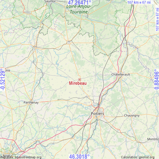
Mirebeau GPS coordinates[2]
46° 47' 7.476" North, 0° 10' 54.624" East
| Map corner | latitude | longitude |
|---|---|---|
| Upper-left | 47.26471°, | -0.52129° |
| Center: | 46.78541°, | 0.18184° |
| Lower-right: | 46.3018°, | 0.88496° |
| Map W x H: | 107.1×107.1 km | = 66.5×66.5mi |
| max Lat: | 51.07786° ⇑57.3% North |
| Mirebeau: | 46.78541° |
| min Lat: | ⇓42.7% South 41.3874° |
| min Long | Mirebeau | max Long |
| -5.08615° | 0.18184° | 9.52242° |
| W 23.5%⇐ | ⇒76.5% E |
Elevation
Elevation of Mirebeau is 150 m = 492 ft, and this is 43.7 m = 143 ft below average elevation for this country.
| Max E: |
2333 m = 7654 ft | 45% |
| Avg. | 193.7 m = 635 ft | |
| Mirebeau | 150 m = 492 ft | |
Min E: |
-1 m = -3 ft | 55% |
See also: France elevation on elevation.city.
Geographical zone
Mirebeau is located in North temperate zone (between Tropic of Cancer and the Arctic Circle). Distance of this North polar circle is 2199.1 km =1366.5 mi to North.| Distance of | km | miles | from Mirebeau |
|---|---|---|---|
| North Pole | 4805 | 2985.7 | to North |
| Arctic Circle | 2199.1 | 1366.5 | to North |
| Tropic Cancer | 2596.1 | 1613.1 | to South |
| Equator | 5202 | 3232.4 | to South |


Nearby cities:
15 places around Mirebeau: (largest is in red/bold)
• Chabournay
9.6 km =6 mi,  142°
142°
• Champigny-le-Sec
7.9 km =4.9 mi,  194°
194°
• Charrais
9.8 km =6.1 mi,  171°
171°
• Cherves
14.6 km =9.1 mi,  239°
239°
• Chouppes
3.2 km =2 mi,  334°
334°
• Cissé
15.9 km =9.9 mi, 167°
• Doussay
9.6 km =6 mi,  47°
47°
• Le Rochereau
8.9 km =5.5 mi, 193°
• Lencloître
11.6 km =7.2 mi,  73°
73°
• Marigny-Brizay
15.4 km =9.6 mi,  106°
106°
• Monts-sur-Guesnes
15 km =9.3 mi,  8°
8°
• Neuville-de-Poitou
12.1 km =7.5 mi,  156°
156°
• Saint-Jean-de-Sauves
9.2 km =5.7 mi,  312°
312°
• Thurageau
4.9 km =3 mi, 112°
• Vendeuvre-du-Poitou
11.2 km =7 mi,  119°
119°
Sources, notices
• [Note1] Compared only with cities in France existing in our database
• [Src1] Map data: © OpenStreetMap contributors (CC-BY-SA)
• [Src2] Other city data from geonames.org with taken over terms of usage.
• [Src3] Geographical zone / Annual Mean Temperature by Robert A. Rohde @ Wikipedia
