Chouppes geodata
Chouppes (Nouvelle-Aquitaine) is a populated place; located in France in Europe/Paris (GMT+2) time zone. With population of 745 people, there are 11223 cities with bigger population in this country. Compared to other cities in France, 57.1% of cities are located further ↑North; 76.6% of cities are located further →East and 63.2% of cities have higher elevation than Chouppes. Note1
Administrative division(s):
- Level 1: Nouvelle-Aquitaine
- Level 2: Vienne
- Level 3: Arrondissement de Poitiers
- Level 4: Chouppes


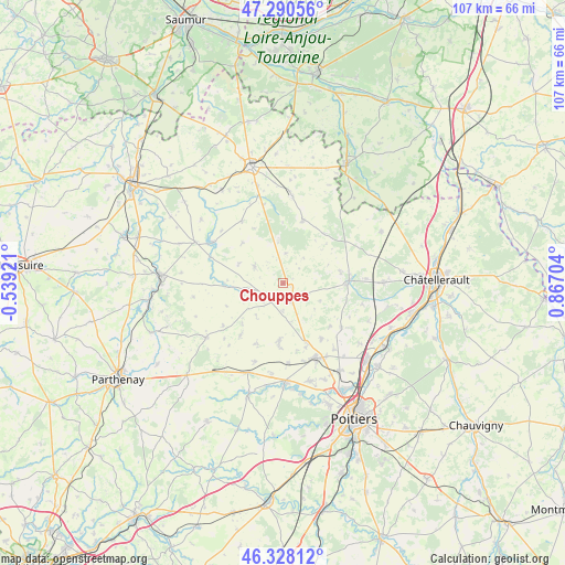
Chouppes GPS coordinates[2]
46° 48' 41.364" North, 0° 9' 50.112" East
| Map corner | latitude | longitude |
|---|---|---|
| Upper-left | 47.29056°, | -0.53921° |
| Center: | 46.81149°, | 0.16392° |
| Lower-right: | 46.32812°, | 0.86704° |
| Map W x H: | 107×107 km | = 66.5×66.5mi |
| max Lat: | 51.07786° ⇑57.1% North |
| Chouppes: | 46.81149° |
| min Lat: | ⇓42.9% South 41.3874° |
| min Long | Chouppes | max Long |
| -5.08615° | 0.16392° | 9.52242° |
| W 23.4%⇐ | ⇒76.6% E |
Elevation
Elevation of Chouppes is 94 m = 308 ft, and this is 99.7 m = 327 ft below average elevation for this country.
| Max E: |
2333 m = 7654 ft | 63.2% |
| Avg. | 193.7 m = 635 ft | |
| Chouppes | 94 m = 308 ft | |
Min E: |
-1 m = -3 ft | 36.8% |
See also: France elevation on elevation.city.
Geographical zone
Chouppes is located in North temperate zone (between Tropic of Cancer and the Arctic Circle). Distance of this North polar circle is 2196.2 km =1364.7 mi to North.| Distance of | km | miles | from Chouppes |
|---|---|---|---|
| North Pole | 4802.1 | 2983.9 | to North |
| Arctic Circle | 2196.2 | 1364.7 | to North |
| Tropic Cancer | 2599 | 1614.9 | to South |
| Equator | 5204.9 | 3234.2 | to South |


Nearby cities:
15 places around Chouppes: (largest is in red/bold)
• Angliers
15.4 km =9.6 mi,  346°
346°
• Chabournay
12.7 km =7.9 mi,  145°
145°
• Champigny-le-Sec
10.6 km =6.6 mi,  183°
183°
• Charrais
12.9 km =8 mi,  167°
167°
• Cherves
15.2 km =9.4 mi,  227°
227°
• Doussay
9.2 km =5.7 mi,  67°
67°
• Le Rochereau
11.6 km =7.2 mi, 183°
• Lencloître
12.5 km =7.8 mi,  88°
88°
• Mirebeau
3.2 km =2 mi, 154°
• Moncontour
15.9 km =9.9 mi,  299°
299°
• Monts-sur-Guesnes
12.5 km =7.8 mi,  16°
16°
• Neuville-de-Poitou
15.3 km =9.5 mi,  156°
156°
• Saint-Jean-de-Sauves
6.3 km =3.9 mi, 300°
• Thurageau
7.6 km =4.7 mi,  128°
128°
• Vendeuvre-du-Poitou
13.9 km =8.6 mi, 127°
Sources, notices
• [Note1] Compared only with cities in France existing in our database
• [Src1] Map data: © OpenStreetMap contributors (CC-BY-SA)
• [Src2] Other city data from geonames.org with taken over terms of usage.
• [Src3] Geographical zone / Annual Mean Temperature by Robert A. Rohde @ Wikipedia
