Champforgeuil geodata
Champforgeuil (Bourgogne-Franche-Comté) is a populated place; located in France in Europe/Paris (GMT+2) time zone. With population of 2,206 people, there are 4355 cities with bigger population in this country. Compared to other cities in France, 57% of cities are located further ↑North; 75.6% of cities are located further ←West and 63.1% of cities have lower elevation than Champforgeuil. Note1
Administrative division(s):
- Level 1: Bourgogne-Franche-Comté
- Level 2: Département de Saône-et-Loire
- Level 3: Arrondissement de Chalon-sur-Saône
- Level 4: Champforgeuil


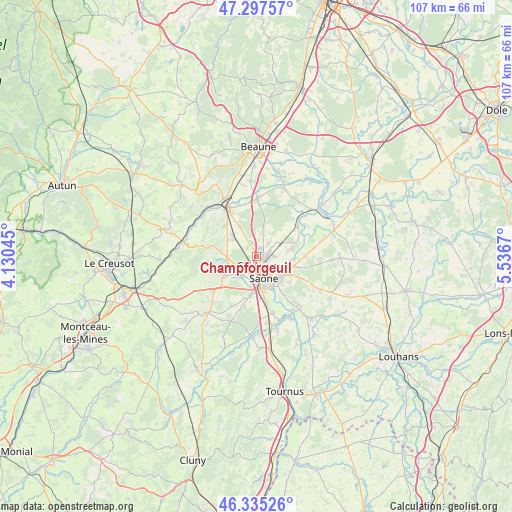
Champforgeuil GPS coordinates[2]
46° 49' 6.852" North, 4° 50' 0.852" East
| Map corner | latitude | longitude |
|---|---|---|
| Upper-left | 47.29757°, | 4.13045° |
| Center: | 46.81857°, | 4.83357° |
| Lower-right: | 46.33526°, | 5.5367° |
| Map W x H: | 107×107 km | = 66.5×66.5mi |
| max Lat: | 51.07786° ⇑57% North |
| Champforgeuil: | 46.81857° |
| min Lat: | ⇓43% South 41.3874° |
| min Long | Champforgeuil | max Long |
| -5.08615° | 4.83357° | 9.52242° |
| W 75.6%⇐ | ⇒24.4% E |
Elevation
Elevation of Champforgeuil is 185 m = 607 ft, and this is 8.7 m = 29 ft below average elevation for this country.
| Max E: |
2333 m = 7654 ft | 36.9% |
| Avg. | 193.7 m = 635 ft | |
| Champforgeuil | 185 m = 607 ft | |
Min E: |
-1 m = -3 ft | 63.1% |
See also: France elevation on elevation.city.
Geographical zone
Champforgeuil is located in North temperate zone (between Tropic of Cancer and the Arctic Circle). Distance of this North polar circle is 2195.4 km =1364.2 mi to North.| Distance of | km | miles | from Champforgeuil |
|---|---|---|---|
| North Pole | 4801.3 | 2983.4 | to North |
| Arctic Circle | 2195.4 | 1364.2 | to North |
| Tropic Cancer | 2599.8 | 1615.4 | to South |
| Equator | 5205.7 | 3234.7 | to South |


Nearby cities:
15 places around Champforgeuil: (largest is in red/bold)
• Chalon-sur-Saône
4.4 km =2.7 mi,  159°
159°
• Châtenoy-en-Bresse
6.7 km =4.2 mi,  116°
116°
• Châtenoy-le-Royal
2.8 km =1.7 mi,  215°
215°
• Crissey
3.7 km =2.3 mi,  93°
93°
• Dracy-le-Fort
5.9 km =3.7 mi,  246°
246°
• Farges-lès-Chalon
2.6 km =1.6 mi,  311°
311°
• Fontaines
5.9 km =3.7 mi, 305°
• Fragnes
2.1 km =1.3 mi,  23°
23°
• Givry
8 km =5 mi,  239°
239°
• Lessard-le-National
5.3 km =3.3 mi,  3°
3°
• Oslon
7.9 km =4.9 mi, 119°
• Saint-Marcel
6.7 km =4.2 mi,  138°
138°
• Saint-Rémy
6.2 km =3.9 mi,  175°
175°
• Sassenay
7.1 km =4.4 mi,  79°
79°
• Virey-le-Grand
3 km =1.9 mi,  56°
56°
Sources, notices
• [Note1] Compared only with cities in France existing in our database
• [Src1] Map data: © OpenStreetMap contributors (CC-BY-SA)
• [Src2] Other city data from geonames.org with taken over terms of usage.
• [Src3] Geographical zone / Annual Mean Temperature by Robert A. Rohde @ Wikipedia
