Champagne geodata
Champagne (Auvergne-Rhône-Alpes) is a populated place; located in France in Europe/Paris (GMT+2) time zone. With population of 690 people, there are 11939 cities with bigger population in this country. Compared to other cities in France, 63% of cities are located further ↑North; 80% of cities are located further ←West and 72% of cities have lower elevation than Champagne. Note1
Administrative division(s):
- Level 1: Auvergne-Rhône-Alpes
- Level 2: Département de l'Ain
- Level 3: Arrondissement de Bourg-en-Bresse
- Level 4: Viriat


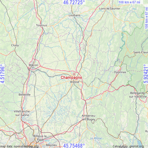
Champagne GPS coordinates[2]
46° 14' 35.232" North, 5° 13' 15.888" East
| Map corner | latitude | longitude |
|---|---|---|
| Upper-left | 46.72725°, | 4.51796° |
| Center: | 46.24312°, | 5.22108° |
| Lower-right: | 45.75468°, | 5.92421° |
| Map W x H: | 108.1×108.1 km | = 67.2×67.2mi |
| max Lat: | 51.07786° ⇑63% North |
| Champagne: | 46.24312° |
| min Lat: | ⇓37% South 41.3874° |
| min Long | Champagne | max Long |
| -5.08615° | 5.22108° | 9.52242° |
| W 80%⇐ | ⇒20% E |
Elevation
Elevation of Champagne is 230 m = 755 ft, and this is 36.3 m = 119 ft above average elevation for this country.
| Max E: |
2333 m = 7654 ft | 28% |
| Champagne | 230 m 755 ft | |
| Avg. | 193.7 m = 635 ft | |
Min E: |
-1 m = -3 ft | 72% |
See also: France elevation on elevation.city.
Geographical zone
Champagne is located in North temperate zone (between Tropic of Cancer and the Arctic Circle). Distance of this North polar circle is 2259.4 km =1403.9 mi to North.| Distance of | km | miles | from Champagne |
|---|---|---|---|
| North Pole | 4865.3 | 3023.2 | to North |
| Arctic Circle | 2259.4 | 1403.9 | to North |
| Tropic Cancer | 2535.8 | 1575.7 | to South |
| Equator | 5141.8 | 3195 | to South |


Nearby cities:
15 places around Champagne: (largest is in red/bold)
• Attignat
6.6 km =4.1 mi,  315°
315°
• Bourg-en-Bresse
4.2 km =2.6 mi,  175°
175°
• Buellas
7.7 km =4.8 mi,  242°
242°
• Cras-sur-Reyssouze
8.1 km =5 mi,  332°
332°
• Jasseron
8.7 km =5.4 mi,  112°
112°
• Montcet
9 km =5.6 mi,  247°
247°
• Montracol
9.3 km =5.8 mi, 236°
• Polliat
7.3 km =4.5 mi,  274°
274°
• Péronnas
6.7 km =4.2 mi,  186°
186°
• Saint-Denis-lès-Bourg
5.2 km =3.2 mi,  208°
208°
• Saint-Just
7.3 km =4.5 mi,  142°
142°
• Saint-Martin-le-Châtel
9 km =5.6 mi,  296°
296°
• Saint-Rémy
7.3 km =4.5 mi,  215°
215°
• Saint-Étienne-du-Bois
7.7 km =4.8 mi,  47°
47°
• Viriat
1.4 km =0.9 mi,  342°
342°
Sources, notices
• [Note1] Compared only with cities in France existing in our database
• [Src1] Map data: © OpenStreetMap contributors (CC-BY-SA)
• [Src2] Other city data from geonames.org with taken over terms of usage.
• [Src3] Geographical zone / Annual Mean Temperature by Robert A. Rohde @ Wikipedia
